Loading...
4th QUARTER 2ND SUMMATIVE TEST IN DRRR
Quiz by BOBBY GREGORIO
Tag the questions with any skills you have. Your dashboard will track each student's mastery of each skill.
Which of the following precedes a debris flow?
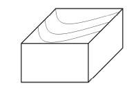
Which of the following areas is most prone to landslide?
Which of these indicate movement of geologic material that results to long cracks and deformation of road segments?
Cracks found on flat ground created by extensional stress are caused by:
Which of the following is a natural sign of an impending sinkhole?
Which of the following is NOT caused by soil shifting downwards as a sign of an impending sinkhole?
Which of the following statements is true about signs of impending geologic hazard?
Which of the following is the reason why seeps and springs suddenly appear as indication of a landslide?
Which of the following is a natural sign of a possible landslide?
Which of these is not included in Geological Map features?
What do the colors on a geologic map represent?
Which is NOT true about Geological Map?
What Fault movement is being shown below?
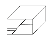
What fault movement is being shown below?
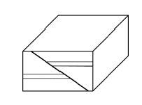
What fault movement is being shown below?
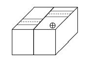
What fault movement is being shown below?
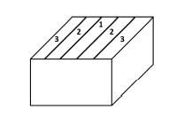
What fault movement is being shown below?
Which of these is a Symbols in Geological Maps?
Which of the following indicates that the whole region is unstable?
Which of the following pertain to a patch of angled forest on a slope?