
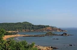
COASTAL PLAINS AND ISLANDS
Quiz by RITIKA OBEROI
Customize this quiz to suit your class
Instantly translate to 100+ languages
Tag the questions with any skills you have. Your dashboard will track each student's mastery of each skill.
Give this quiz to my class
​The western coastal plains are located between _________ and the _______
Eastern Ghats and Arabian Sea
Western Ghats and Bay of Bengal
Western Ghats and Indian Ocean
Western Ghats and the Arabian Sea
​The coastal plains stretch from __________ to ______________ covering a coastline of approximately 6000 kms. The two coastal plains meet at ___________
Konkan Coast, Cormoandel Coast, Kanyakumari
Gujarat, West Bengal, Kanyakumari
Gujarat, West Bengal, Indira point
Western coastal plains, Eastern coastal plains, Kanyakumari
The western coastal plains are located between _________ and the _______
The coastal plains stretch from __________ to ______________ covering a coastline of approximately 6000 kms. The two coastal plains meet at ___________
Kerala is in the ________________ part of the Malabar coast.
__________ and _______________ are popular folk dances of Gujarat
The Andaman and Nicobar islands are a cluster of over _________ islands and only ________ are inhabited.
The Andaman and Nicobar islands are separated from each other by the ____________
A ________ is a shallow __________ water lake separated from the ______ by an are of rock and sand.
Think about the geography and location of the city or town you live in. Are there bodies of water like rivers and lakes or a coast nearby? Perhaps you live in a place with vast open fields suitable for farming or raising livestock. The natural environment is important when understanding how cities and towns developed. The earliest North American colonies depended on their natural environment. The type of soil, climate, length of seasons, and proximity to bodies of water all played a role in how each colony prospered. By the 1700’s, the American colonies grew into three distinct regions. The New England, Middle, and Southern regions each had different geographical and cultural characteristics that determined the development of their economy, society, and relationships to each other. The New England Colonies included Connecticut, Rhode Island, Massachusetts, and New Hampshire. The geography of this region featured dense forests and hills. Combined with the hard rocky land, cold climate and long winters, New England was a poor area for large farming operations. However, many colonists known as "yeoman farmers" had small family-owned farms that grew a variety of crops. Many other colonists relied on fishing and whaling off the New England coast. Others settled in small towns and became craftsmen or merchants. The forests provided excellent lumber for building boats and homes for the growing population. Many of the settlers to the New England Colonies were Puritans, hardworking, and very religious. Close families and strong communities were very important to them. The Middle Colonies included Pennsylvania, Delaware, New York, and New Jersey. The geography of this region featured a warmer climate with fertile soil, flat land, easily navigable rivers, and wide valleys making it perfect for farming and growing crops. Wealthy farmers grew cash crops and raised livestock. Mining and trading were also important aspects of the economy here. Over time, cities grew, and urban merchants sold and traded goods with people throughout the other colonies. Compared to other regions, the people of the middle colonies supported religious freedom and tolerance and had a diverse population with settlers arriving from many areas in Europe. The Southern Colonies included the first English colony of Virginia, and grew to include Maryland, North Carolina, South Carolina, and Georgia. The geography included rich, fertile soil with broad coastal plains that made it possible for large plantations to grow tobacco, rice, and indigo. Most of these plantations featured a labor force of enslaved Black people. These enslaved men, women, and children had few, if any, rights and often saw their families torn apart at the whim of the plantation owner. Enslaved children were even put to work as young as age three, weeding fields, carrying drinking water, or helping in the home. Smaller farms owned by subsistence farmers also existed across the Southern Colonies. Often, the people working these would grow crops for their families with little left over to sell or trade. Indentured servants also arrived in the South who would work for 5-7 years in exchange for their passage to North America. The Church of England (also known as the Anglican Church) was the dominant religion in the region. Most settlers to the South did not come for religious freedom like they did in the northern colonies. Therefore, they often maintained their allegiance to the established Church of England.
Create a 4 question multiple-choice quiz for 4th grade Texas History over the different characteristics of the four regions of Texas: Great Plains, Coastal Plains, Central Plains, and Mountains and Basins
Chapter 8: The Worlds of North and South Geography Geography refers to the seasons, climate, soil, and physical features of a region (mountains, rivers, etc.) The differences in geography b/t the N and S is one of the major reasons slavery b/c entrenched in the S while it died out in the N. Geography of the North The N has diverse geography and experiences four distinct seasons including long, harsh winters. The Great Plains region has some of the best farmland in the country. New England has rocky, hilly wilderness, not well suited for farming. It has hundreds of bays and harbors along its coastline. States farther S had rich soil and coastal access through rivers. The N also experienced mass deforestation b/c of the need for lumber and to make room for farms. Geography of the South Climate: the S had mild winters, and a long, hot, humid growing season. It has fertile lowlands, marshes and swamps. It's ideal for growing tobacco, sugar, rice, indigo, and cotton (cash crops). B/c of the geography of the S, their whole way of life was based on agriculture and geography is one of the major reasons why slavery took off in the S. Economies Economy basically refers to the way people make and spend money. The Northern economy was far more diversified than the Southern. Economy of the North The North experienced the Industrial Revolution—the shift from handmade goods to machine-made goods. This resulted in new jobs, increased production, and improved efficiency in agriculture. IOW, you can make things faster, easier, and cheaper. More ppl get more stuff. Factories were almost always located next to rivers. The Reaper The Indust. Rev. changed northern agriculture with Cyrus McCormick’s reaper. It could cut 28xs more grain than a single man. The Sewing Machine Elias Howe's sewing machine; At 250 stitches a minute, Howe's lockstitch mechanism out-stitched the output of five hand seamstresses with a reputation for speed, completing in one hour what took the sewers 14.5 hours. The Textile Mill Francis Cabot Lowell's textile mill: essentially the first factory in the US, Lowell set the model for all future factories. Interchangeable Parts Eli Whitney's interchangeable parts; considered the "dawning of a new age" of machinery. This concept was applied to pretty much all manufacturing. Economy of the South The South's economy was based on AGRICULTURE. Most southerners were agrarians. Most had small farms, some owned plantations. Slavery beginning to decline in late 1700s; prices went down (tobacco, indigo) and cotton was difficult. King Cotton Cotton was South’s most important crop. Earned more money than all other exports combined. The S would go on to supply 75% of the world's cotton demand. Cotton Gin Eli Whitney invented the cotton gin in 1794 and forever changed the US. The gin made cotton incredibly profitable. We start to see the effects of the cotton gin around 1820. Slavery and Cotton Southerners put all their money into slaves and land, and almost none into building factories. With the spread of cotton, demand for slaves increased. 1790 to 1850, number of slaves rose 600%. Transportation Again, the N was far more inventive in their approach to transportation than the S. Transportation in the North National Road National Road stretched from the East (the Potomac), over the Appalachians, to the West (Illinois), over 620 miles. Steamboat In 1807, Robert Fulton invented the steamboat. It traveled 150 miles UP the Hudson River at a speed of 5 mph. Erie Canal Built b/t 1817 and 1825, the canal spanned 363 miles and connected Lake Erie to the Hudson River. This connected farms in the W to cities in the E and the Atlantic Ocean. Clipper Ship Clippers were narrow w massive sails that were built for speed. They cut the time it took to cross the Atlantic in half. Locomotive The fastest and cheapest way to move goods was by steam-powered trains. The first RR was the B&O which was built in 1827. Transportation in the South Most people and goods in the South traveled by rivers in steamboats. The South had trains, but less than half the amount of railroad track than the North had. Society (The People) The people who made up the N and S could not have been more different. The S was primarily agrarian while the N was b/c urbanized. The S was holding on to the past, while the N was embracing change. Society in the South Society was organized into 3 distinct classes of people: rich plantation owners at the top; then white farmers and workers; slaves on the bottom. This rigid social class system was the result of a slave-based agricultural system. Power Structure Only 1 in 4 whites owned a slave. Plantation owners, who owned more than 20 slaves, dominated politics and the economy. Society in the North 7 of 10 Northerners still lived on farms by the 1840s (6 of 10 by 1860), but urbanization was growing fast in the N. The N relied on wage labor as opposed to slave labor, so most blacks in the N were free. N blacks were not treated equally and the N was about as racist as the S. Immigration Compared to the S, the N population was exploding, in large part bc of immigration. Between 1845 and 1860, 4 million immigrants came to the North. Most were German and Irish. Irish--a potato famine; German--a failed revolution. Ethnic neighborhoods developed as a result.
Geography and Natural Resources of the Coastal Plain - Exit Quiz
Geography and Natural Resources of the Coastal Plain - Starter Quiz
Marine and Coastal Processes.What are the hazards that usually occur along marine and coastal areas? Coastal processes, such as waves, tides, sea level changes, crustal movement, and storm surges will result to coastal erosion, submersion, and saltwater intrusion. Coastal Erosion. Coastal erosion is the wearing down of the coastlines by the movement of wind and water. It is not a constant process; instead, the rate of erosion depends on other events such as cyclones. When cyclones occur along coastal areas, the winds and waves carry the sediment away from the shoreline. Shorelines play an important role to society. They are used in transportation, fishing, and tourism. Therefore, preventing coastal erosion is of utmost priority. There are three main classifications of stabilizing the shoreline: hard stabilization, soft stabilization, and retreat. 1. Hard stabilization is done by building structures that will slow down the erosion on areas that are prone to erosion. Examples of hard stabilization structures are jetties, sea walls, and breakwaters. Though they may slow down the erosion in one area, it may hasten the erosion in other areas. 2. Soft stabilization includes the process of beach nourishment, wherein sand from an offshore location is brought to an area with a receding shoreline. It does not make use of structures like the ones used in hard stabilization. 3. Retreat is the option taken by residents near areas where coastal erosion is already severe. At this point, the authorities no longer attempt to save the shoreline but rather limit the amount of human interference in the area. Submersion. Coastal erosion happens because of the interaction of the winds and waves on the shoreline. Submersion, on the other hand, happens because of the changes in the sea level, specifically, when it rises dangerously above the normal level. This is all due to the increase in the global temperature, which, in turn, melts the glacial deposits and increases the overall sea level. Another factor that may cause submersion is the vertical movement of the plates. Landmasses can be uplifted, which can also cause changes in the sea level. It can also be caused by tsunamis and storm surges. Submersion will most likely occur in reclaimed lands. These are the areas that were originally part of oceans, riverbeds, or lakebeds. They are low-lying flatlands, so even a small rise in sea level can cause great damage on the land. To prevent this from happening not only in reclaimed lands but also in coastal areas, a hard stabilization technique is used. Sea walls are built along the coastline to protect the land from being easily flooded. Aside from sea walls, dikes can also help prevent flooding. The government can also upgrade the infrastructures built in coastal areas, regenerate mangroves, or relocate the people. There are also other proposed strategies to mitigate coastal submersion, such as imposing of setback policies and construction regulations and creating adaptive plans for coastal management. Saltwater Intrusion. In coastal areas where there is an interaction between saltwater and fresh water, saltwater intrusion is one of the hazards that are evident in that area. Saltwater intrusion is the movement of saltwater into the freshwater aquifer. The natural flow is that the fresh water, which is less dense, moves towards the denser saltwater. But if the fresh water is being withdrawn faster than it is being replenished, then there will be a change in pressure and saltwater intrusion will occur.There are a few ways of preventing saltwater intrusion. One is to stop using the well where fresh water has been depleted and let the groundwater replenish naturally via the water cycle. The other method is to build two wells: a pumping well-built farther inland and an injection well-built closer to the coast. Using the injection well, fresh water is pumped into the aquifer to prevent the saltwater from intruding. The different marine and coastal hazards often occur in the Philippines, being an archipelago with the longest coastline. Manila Bay is one of the coastal areas of the Philippines that is facing various threats from both natural and anthropological causes. Saltwater intrusion occurs due to uncontrolled withdrawal of groundwater to be used by residential, commercial, and industrial areas built around the bay. It is also frequently flooded due to poor drainage systems and improper disposal of waste. Since Manila Bay is shared by four coastal provinces, four noncoastal provinces, and the National Capital Region, each local government unit and national agencies need to collaborate in planning, developing, and managing its marine and coastal resources. And it is not only Manila Bay but other parts as well, for as long as they are in coastal areas, hazards will mostly likely occur if not immediately addressed.
Tobruk, a small town on the Libyan coast, was central to much of the fighting that took place in the Western Desert during the Second World War. It had originally been developed by the Italians during their colonisation of eastern Libya during the early decades of the 20th century. With a sheltered deep water harbour it became a key naval outpost. It was fortified during the 1930s with both coastal defence batteries and a 50 kilometre-long perimeter of reinforced concrete platoon posts, and other supporting infrastructure such as gun positions, headquarters bunkers, underground supply dumps, and observation towers. When British and Commonwealth forces advanced out of Egypt and into Libya in January 1941, Tobruk was their second objective. The Italian defence perimeter was attacked by the 6th Australian Division on the morning of 22 January and the town fell the next morning. The operation resulted in approximately 27,000 Italian prisoners and the capture of over 200 artillery pieces, but cost 49 Australian lives. The 6th Division's advance pressed on beyond Tobruk and eventually they were withdrawn from Libya to be deployed to Greece.The 9th Australian Division was moved in to Libya in February 1941 to garrison the territory captured by the 6th. By this time, however, German troops had arrived in Libya to reinforce their Italian allies and they launched an offensive that the British Commonwealth forces were ill-disposed to hold back. A retreat towards Egypt commenced. The 9th Division was ordered to fall back upon Tobruk, hold it in order deny its port facilities to the Germans, and delay their advance so as to provide time for defences on the Egyptian frontier to be prepared. Tobruk and the 9th Division were subsequently encircled, beginning what became known as "the siege of Tobruk". Reinforced by the 18th Brigade of the 7th Australian Division and other British and Commonwealth troops, and resupplied by the sea, the 9th Division held Tobruk from April to September 1941. During this period it repelled two major German attacks. In September and October the 9th Division, its condition steadily declining, was relieved by the British 70th Division, which continued to defend Tobruk until the siege was finally lifted by Operation Crusader in December. The defence of Tobruk resulted in 749 Australian deaths, and another 604 became prisoners of war. Tobruk was the scene of further heavy fighting in June 1942 when the fortunes of war again saw a British Commonwealth force seeking to deny the port to the enemy. The Axis forces, however, were in no mood for another siege and launched a massive attack to capture it on 20 June. It remained in their hands until their final retreat from Libya in November 1942.John Hurst Edmondson (1914-1941), soldier, was born on 8 October 1914 at Wagga Wagga, New South Wales, only child of native-born parents Joseph William Edmondson, farmer, and his wife Maude Elizabeth, née Hurst. The family moved to a farm near Liverpool when Jack was a child. Educated at Hurlstone Agricultural High School, he worked with his father and became a champion rifle-shooter. He was a council-member of the Liverpool Agricultural Society and acted as a steward at its shows. Having served (from March 1939) in the 4th Battalion, Militia, he enlisted in the Australian Imperial Force on 20 May 1940 and was posted to the 2nd/17th Battalion. Later that month he was promoted acting corporal (substantive in November). Well built and about 5 ft 9 ins (175 cm) tall, Edmondson settled easily into army life and was known as a quiet but efficient soldier. His battalion embarked for the Middle East in October and trained in Palestine. In March 1941 the 2nd/17th moved with other components of the 9th Division to Libya and reached Marsa Brega before an Axis counter-attack forced them to retreat to Tobruk. The siege of the fortress began on 11 April. Two days later the Germans probed the perimeter, targeting a section of the line west of the El Adem Road near Post R33. This strong-point was garrisoned by the 2nd/17th's No.16 Platoon in which Edmondson was a section leader. The enemy intended to clear the post as a bridgehead for an armoured assault on Tobruk.Under cover of darkness thirty Germans infiltrated the barbed wire defences, bringing machine-guns, mortars and two light field-guns. Lieutenant Austin Mackell, commanding No.16 Platoon, led Edmondson's five-man section in an attempt to repel the intruders. Armed with rifles, fixed bayonets and grenades, the party of seven tried to outflank the Germans, but were spotted by the enemy who turned their machine-guns on them. Unknown to his mates, Edmondson was severely wounded in the neck and stomach. Covering fire from R33 ceased at the pre-arranged time of 11.45 p.m. and Mackell ordered his men to charge. Despite his wounds, Edmondson accounted for several enemy soldiers and saved Mackell's life. When the remaining Germans fled, the Australians returned to their lines. Although Edmondson was treated for his wounds, he died before dawn on 14 April 1941. The Germans' armoured attack that morning was thwarted, partly due to the earlier disruption of their plans. Edmondson was buried in Tobruk war cemetery. He had not married. His Victoria Cross, gazetted on 4 July, was the first awarded to a member of Australia's armed forces in World War II. In April 1960 Mrs Edmondson gave her son's medals to the Australian War Memorial, Canberra, where they are displayed alongside his portrait (1958) by Joshua Smith. At Liverpool a public clock commemorates Edmondson, as do the clubrooms used by the sub-branch of the Returned Services League of Australia.Perhaps my nerves will be more under control when I am by myself. There were no entries in the diary until Friday April 18 when she wrote: Fighting terrific in Greece and North Africa…. I dread the casualty list also the heaviest air raid over London to date. Account …. of heavy fighting and much use of bayonet at Tobruk. Also gives an account of a charge in which a Lieutenant and a Corporal took prominent parts on Easter Sunday night. Of course, no names. When I read it …. I was sure the Corporal was Jack…. It said no casualties but …. I know … that all is not well with Jack. ….. (and) Stuffy ….has not come home yet. On Wednesday April 23 she received a letter from Jack dated March 30 and for the first time he said the conditions were bad. The food short, water one bottle for 48 hours. It worried me terribly so I posted a parcel (of) milk tablets, chocolate milk, biscuits (and) cigarettes.Tuesday April 15 I was feeling afraid of something while I was working and packing the cake (and) had a couple of brandys to (keep going).April 26 Received the following telegram in the mail, the bus man brought it in. “It is with deep regret that I have to inform you that Corporal John Hurst Edmondson was killed in action on the 14th April and desire to convey the profound sympathy of the Ministry for the Army and the Military Board.”Her final entry
Coastal erosion landforms