Geography
Quiz by Matt Swanson
Feel free to use or edit a copy
includes Teacher and Student dashboards
Measure skillsfrom any curriculum
Measure skills
from any curriculum
Tag the questions with any skills you have. Your dashboard will track each student's mastery of each skill.
With a free account, teachers can
- edit the questions
- save a copy for later
- start a class game
- automatically assign follow-up activities based on students’ scores
- assign as homework
- share a link with colleagues
- print as a bubble sheet
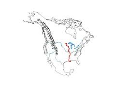
- Q 1/62Score 0river flowing north to south, from Minnesota to the Gulf of Mexico; used for traveling and moving goods; borders 10 states29Mississippi River


62 questions
Show answers
- Q1river flowing north to south, from Minnesota to the Gulf of Mexico; used for traveling and moving goods; borders 10 statesMississippi River30s
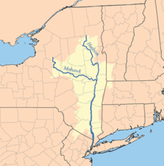
- Q2river flowing from Northeast New York south into the Atlantic Ocean; used for traveling and moving goodsHudson River30s
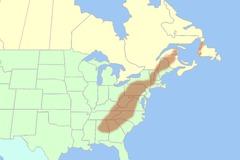
- Q3eastern mountains from Maine to Alabama; used by British to block colonists from moving westwardAppalachian Mountain Range30s
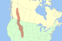
- Q4western mountains from Idaho to New MexicoRocky Mountain Range30s
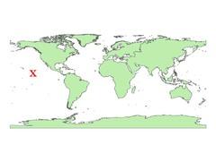
- Q5ocean found on the east coast of North America; borders states like Maine, New York, and Delaware; separates North America from EuropeAtlantic Ocean30s
- Q6ocean found on west coast of North America, borders states like Oregon and California; separates North America from AsiaPacific Ocean30s
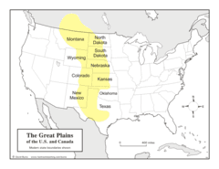
- Q7flat land found between Missouri River and Rocky Mountains; used for farming; found in 10 states like Colorado and MontanaGreat Plains30s
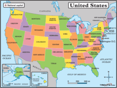
- Q8used to show states and their political bordersPolitical Map of USA30s
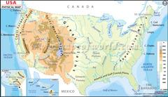
- Q9used to geographical features and topography (landforms) such as mountain ranges, rivers, and plainsPhysical Map of USA30s
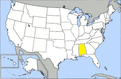
- Q10See imageAlabama30s
- Q11See imageAlaska30s
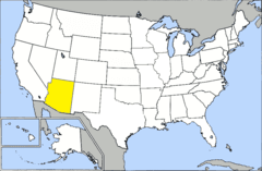
- Q12See imageArizona30s
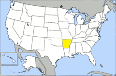
- Q13See imageArkansas30s
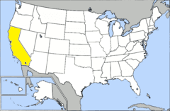
- Q14See imageCalifornia30s
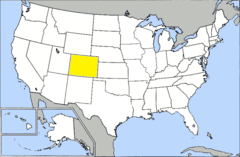
- Q15See imageColorado30s