Loading...
Geography Tools
Quiz by Sheila Vernot
Tag the questions with any skills you have. Your dashboard will track each student's mastery of each skill.
A 3-D model of the Earth
A representation of an area on a flat surface
Consists of satellites, receivers, and ground stations
Any data that describes characteristics of a specific place or location
Images / Pictures that show what a place looks like from above
A computer program that allows a person to view many layers of geographic information on the same map
Mapmaking that is done with the aid of computers
GPS was originally developed by ____
A disadvantage of a map
An advantage of a globe
A disadvantage of remote sensing
What type of map shos rivers, mountains, plateaus, and other landforms?
What type of map shows boundaries of countries and capital cities?
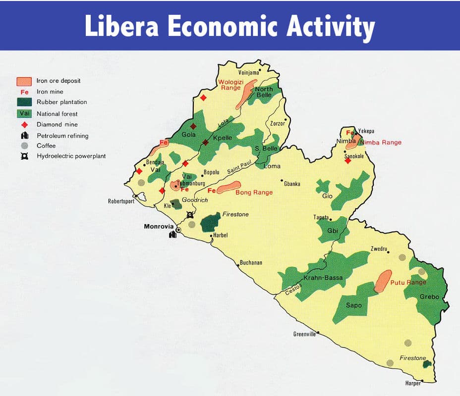
Which is an example of a special purpose map?
What is a type of geographic information that I can learn from this map?
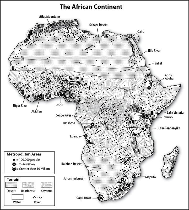
What type of map is shown?
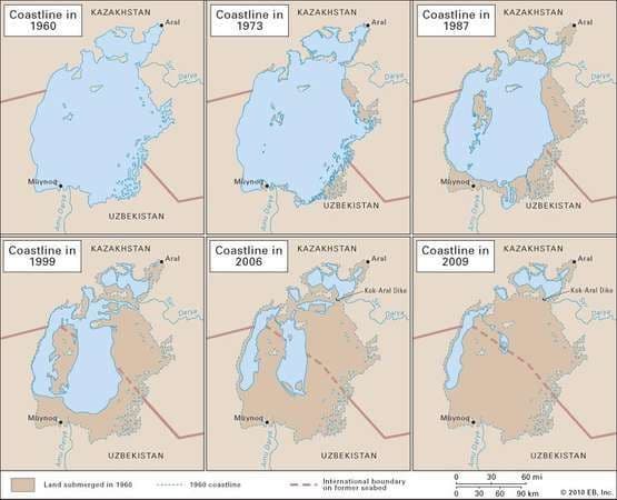
What has happened to the Aral Sea over time?