

Grade 6 Geography
Quiz by Katelyn Hummel
Feel free to use or edit a copy
includes Teacher and Student dashboards
Measures 3 skills from
Measures 3 skills from
With a free account, teachers can
- edit the questions
- save a copy for later
- start a class game
- automatically assign follow-up activities based on students’ scores
- assign as homework
- share a link with colleagues
- print as a bubble sheet
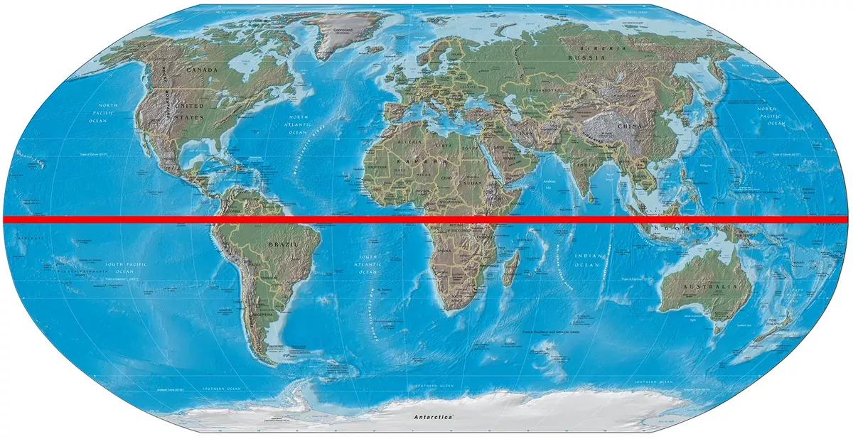
- Q 1/11Score 0Which of the following lines is latitude?29Arctic CirclePrime MeridianTropic of CancerEquator


11 questions
Show answers
- Q1Which of the following lines is latitude?Arctic CirclePrime MeridianTropic of CancerEquator30s6.1a
- Q2What is a compass rose?A symbol that shows directions on a mapA tool for measuring distance on a mapA line that connects points of equal temperatureA type of flower that grows in a specific region30s6.1a
- Q3What is the scale of a map?The way countries and borders are marked on a mapThe height of the mountains depicted on a mapThe climatic conditions of a specific regionThe ratio between the distance on a map and the actual distance on the ground30s6.1a
- Q4Which of the following is a topographic map?A map that shows the average temperature in different regionsA map that shows the elevation and physical features of an areaA map that shows the locations of cities and townsA map that shows the political boundaries of countries30s6.1c
- Q5What is the purpose of a key/legend on a map?To explain the symbols and colors used on the mapTo indicate the scale of the mapTo label important landmarksTo show the direction of North30s6.1a
- Q6What is the purpose of a grid system on a map?To show the average temperature in different regionsTo locate specific points or places on the mapTo display the political boundaries between countriesTo indicate the elevation and topography of an area30s6.1b
- Q7Which of the following is NOT typically represented on a physical map?DesertsMountain rangesCity populationsRivers30s6.1c
- Q8What does a physical map primarily show?Political boundariesPopulation densityClimate patternsLandforms and terrain features30s6.1c
- Q9What type of map provides information regarding the average temperature and precipitation patterns of an area?Climate mapPolitical mapRoad mapTopographic map30s6.1c
- Q10What type of map shows boundaries, cities, and capital locations of different countries?Climate mapRoad mapPolitical mapTopographic map30s6.1b
- Q11What is the purpose of a political map?To show the boundaries and divisions of countries and states.To depict the distribution of population in different areas.To represent the climate patterns of a specific area.To show the historical events that have occurred in a country.To display the physical features of a region, such as mountains and rivers.30s6.1b


