Loading...
INDIA RIVERS MAP POINTING
Quiz by Santosh Thomas
Customize this quiz to suit your class
Instantly translate to 100+ languages
Tag the questions with any skills you have. Your dashboard will track each student's mastery of each skill.
Give this quiz to my class
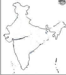
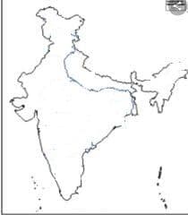
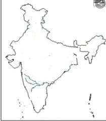
NAME THE RIVER IN THE MAP
NARMADA
GANGA
YAMUNA
BRAHMAPUTRA
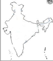
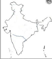
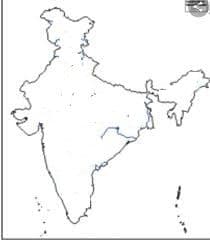
NAME THE RIVER IN THE MAP
NARMADA
YAMUNA
BRAHMAPUTRA
GANGA
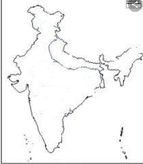
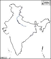
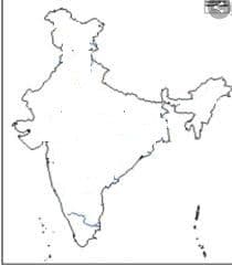
NAME THE RIVER IN THE MAP
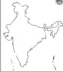
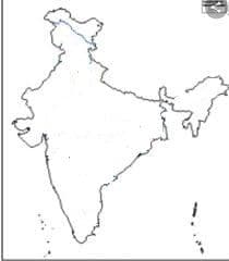
NAME THE RIVER IN THE MAP
NAME THE RIVER IN THE MAP
NAME THE RIVER IN THE MAP
NAME THE RIVER IN THE MAP
NAME THE RIVER IN THE MAP
NAME THE RIVER IN THE MAP
NAME THE RIVER IN THE MAP
NAME THE RIVER IN THE MAP
NAME THE RIVER IN THE MAP