Loading...

Kingdoms of West Africa
Quiz by Amanda Barcellos
Customize this quiz to suit your class
Instantly translate to 100+ languages
Tag the questions with any skills you have. Your dashboard will track each student's mastery of each skill.
​Caravan

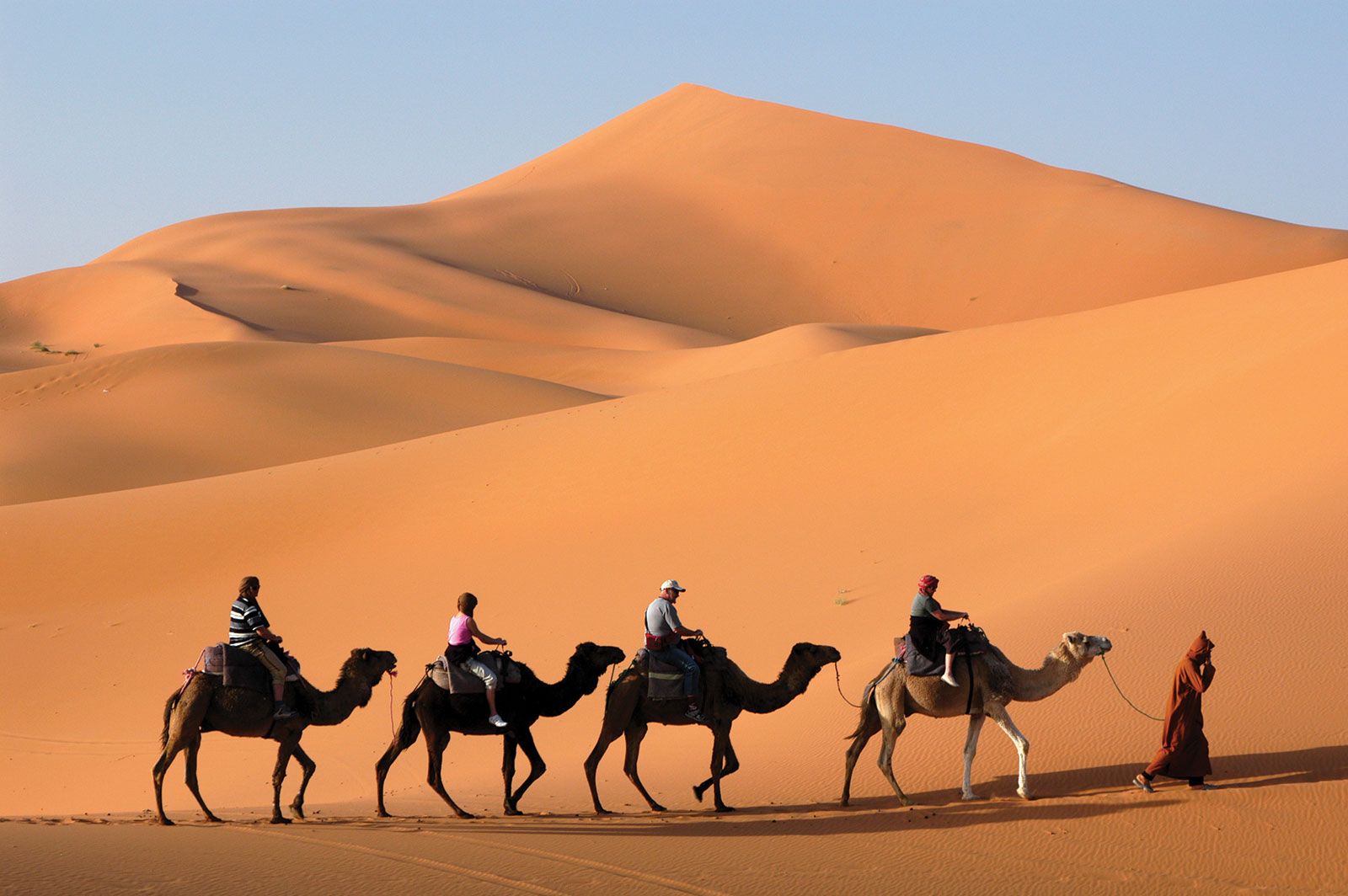
A group of people that travel together
Across the Sahara
 West African storyteller who relates stories through the oral tradition
 A small supply of something
​commodity
Center of learning, art, religion and culture in Mali
A trade good
An area of lush tropical grasslands
Caravan

commodity
Give this quiz to my class
The Benin Kingdom is located in the southern forest of West Africa (Modern Nigeria) and formed by the Edo people, flourished from the 13th to 19th century CE. The capital also is called Benin, it was the hub of a trade network exclusively controlled by the king or Oba and which included relations with Portuguese traders who sought gold and slaves. Benin went into decline during the 18th century. The Benin territory is a mixture of rainforest, dry forest, and mangrove swamp. The heartland was a circle around the capital, also called Benin, extending some 60 kilometers in all directions and was ruled directly by the king. THE OBA OF BENIN This is the traditional ruler and the custodian of the culture of the Edo people and all Edoid people. THE FOLLOWING ARE THE PAST OBAS OF BENIN KINGDOM AND YEAR OF REIGNING. 1. Pre – Imperial Benin (1200- 1440) Eweka 1 (1200 -1235), Uwakhuahen (1235 – 1243), Ehenmihen (1243 – 1255). 2. Imperial Benin ((1440 – 1897) Ewuare the Great (1440 – 1473), Olua (1473 -1480), Ozolua(1483 – 1504). 3. Post- Imperial Benin (1914- Present) Eweka II(1914 – 1933) Akenzua II (1933 – 1978) Erediauwa (1976 – 2016)
A church is a place where Christians worship God. The European missionaries were the first to establish churches in Nigeria. The history of the establishment of churches began in the 16th century and continued in the 19th century. Churches in Nigeria can be categorized as Orthodox, Pentecostal and Spiritual Churches. SOME IMPORTANT HISTORICAL CHURCHES IN NIGERIA. The following are some of the important historical churches in Nigeria: 1. The Cathedral Church of St. Peters: It was established by the Anglican Mission at Ake, Abeokuta in 1898. 2. Holy Aruosa Cathedral: It was established in 1538 by the Portuguese missionaries in Benin Kingdom. 3. The Duke Town Cathedral: It was built by Presbyterian missionaries in 1895 in Calabar. 4. ECWA (Evangelical Church of West Africa): It began its activities in Nigeria in 1893 in Lagos and later moved to Northern Nigeria such as Bida, Zaria, Jos and Ilorin. The headquarters of ECWA is in Jos, Plateau State.
SS Spanish Version 8/25/25 Topic: Fall of Rome, Medieval Europe, and the Role of Monasteries Tema: La caĂda de Roma, la Europa medieval y el papel de los monasterios Reading Passage / Pasaje de Lectura The Roman Empire, once the most powerful civilization in the world, began to weaken during the 4th and 5th centuries. Several causes contributed to its decline, including political corruption, heavy taxes, reliance on slave labor, and invasions by barbarian tribes such as the Visigoths and Vandals. In 476 CE, the last Roman emperor in the West was removed, marking the official fall of the Western Roman Empire. This event brought significant changes to Europe, as centralized government disappeared and smaller kingdoms took control. El Imperio Romano, una vez la civilizaciĂłn más poderosa del mundo, comenzĂł a debilitarse durante los siglos IV y V. Varias causas contribuyeron a su declive, incluyendo la corrupciĂłn polĂtica, los altos impuestos, la dependencia de la mano de obra esclava y las invasiones de tribus bárbaras como los visigodos y los vándalos. En el año 476 d.C., el Ăşltimo emperador romano en Occidente fue depuesto, marcando la caĂda oficial del Imperio Romano Occidental. Este evento trajo cambios significativos a Europa, ya que el gobierno centralizado desapareciĂł y reinos más pequeños tomaron el control. After the fall of Rome, Europe entered the Middle Ages, also known as Medieval Europe. This period lasted roughly from 500 to 1500 CE. Life during this time was shaped by the feudal system, where kings gave land to nobles in exchange for loyalty and military service. Most people were peasants who farmed the land and gave a portion of their harvest to their lords. Castles provided protection, while the Catholic Church became the most powerful institution, guiding people’s beliefs and daily lives. DespuĂ©s de la caĂda de Roma, Europa entrĂł en la Edad Media, tambiĂ©n conocida como la Europa medieval. Este perĂodo durĂł aproximadamente del año 500 al 1500 d.C. La vida durante este tiempo estaba organizada por el sistema feudal, en el cual los reyes daban tierras a los nobles a cambio de lealtad y servicio militar. La mayorĂa de las personas eran campesinos que cultivaban la tierra y entregaban una parte de su cosecha a sus señores. Los castillos brindaban protecciĂłn, mientras que la Iglesia CatĂłlica se convirtiĂł en la instituciĂłn más poderosa, guiando las creencias y la vida diaria de las personas. In the uncertain times of Medieval Europe, monasteries served as centers of learning and stability. Monks lived simple lives dedicated to prayer, work, and study. They carefully copied ancient texts, preserving knowledge from Greece and Rome. Monasteries also offered medical care, shelter to travelers, and food to the poor. In many ways, they became islands of peace and knowledge in a world often filled with war and hardship. En los tiempos inciertos de la Europa medieval, los monasterios sirvieron como centros de aprendizaje y estabilidad. Los monjes vivĂan vidas simples dedicadas a la oraciĂłn, el trabajo y el estudio. Ellos copiaban cuidadosamente textos antiguos, preservando el conocimiento de Grecia y Roma. Los monasterios tambiĂ©n ofrecĂan atenciĂłn mĂ©dica, refugio a viajeros y comida a los pobres. De muchas maneras, se convirtieron en islas de paz y conocimiento en un mundo a menudo lleno de guerras y dificultades.
Geography: the study of Earth’s physical and cultural features Landforms: the natural features of the land’s surface Climate: the average weather conditions in a certain area over a long period of time Environment: All the living and nonliving things that affect life in an area Region: An area with one or more features that make it different from other surrounding areas Map Key / Map Legend: box that explains the meaning of different symbols used on the map Map Scale: tool that measures the relationship between the distance of locations on the map and the distance of locations in real life Compass Rose: a circle that shows the key directions on a map Hemispheres: halves of the Earth Continent: one of seven large landmasses on Earth Oceans: large bodies of water that cover 71% of the Earth’s surface Latitude: imaginary horizontal lines that measure distance north and south of the Equator Equator: central line of latitude that is measured at 0° Longitude: imaginary vertical lines that measure distance east and west of the Prime Meridian Prime Meridian: the central line of longitude, which is measured at 0° and runs through Greenwich, United Kingdom Map: illustration of a specific area on Earth that is often portrayed on a flat surface Physical Map: a type of map that shows the natural landforms and terrain of a location Political Map: a type of map that identifies cities, states, and countries Globe: a spherical model that is the most accurate representation of Earth
Southeast Asia, vast region of Asia situated east of the Indian subcontinent and south of China. It consists of two dissimilar portions: a continental projection (commonly called mainland Southeast Asia) and a string of archipelagoes to the south and east of the mainland (insular Southeast Asia). Extending some 700 miles (1,100 km) southward from the mainland into insular Southeast Asia is the Malay Peninsula; this peninsula structurally is part of the mainland, but it also shares many ecological and cultural affinities with the surrounding islands and thus functions as a bridge between the two regions. Mainland Southeast Asia is divided into the countries of Cambodia, Laos, Myanmar (Burma), Thailand, Vietnam, and the small city-state of Singapore at the southern tip of the Malay Peninsula; Cambodia, Laos, and Vietnam, which occupy the eastern portion of the mainland, often are collectively called the Indochinese Peninsula. Malaysia is both mainland and insular, with a western portion on the Malay Peninsula and an eastern part on the island of Borneo. Except for the small sultanate of Brunei (also on Borneo), the remainder of insular Southeast Asia consists of the archipelagic nations of Indonesia and the Philippines. Southeast Asia stretches some 4,000 miles at its greatest extent (roughly from northwest to southeast) and encompasses some 5,000,000 square miles (13,000,000 square km) of land and sea, of which about 1,736,000 square miles is land. Mount Hkakabo in northern Myanmar on the border with China, at 19,295 feet (5,881 meters), is the highest peak of mainland Southeast Asia. Although the modern nations of the region are sometimes thought of as being small, they are—with the exceptions of Singapore and Brunei—comparatively large. Indonesia, for example, is more than 3,000 miles from west to east (exceeding the west-east extent of the continental United States) and more than 1,000 miles from north to south; the area of Laos is only slightly smaller than that of the United Kingdom; and Myanmar is considerably larger than France. All of Southeast Asia falls within the tropical and subtropical climatic zones, and much of it receives considerable annual precipitation. It is subject to an extensive and regular monsoonal weather system (i.e., one in which the prevailing winds reverse direction every six months) that produces marked wet and dry periods in most of the region. Southeast Asia’s landscape is characterized by three intermingled physical elements: mountain ranges, plains and plateaus, and water in the form of both shallow seas and extensive drainage systems. Of these, the rivers probably have been of the greatest historical and cultural significance, for waterways have decisively shaped forms of settlement and agriculture, determined fundamental political and economic patterns, and helped define the nature of Southeast Asians’ worldview and distinctive cultural syncretism. It also has been of great importance that Southeast Asia, which is the most easily accessible tropical region in the world, lies strategically astride the sea passage between East Asia and the Middle Eastern–Mediterranean world. Within this broad outline, Southeast Asia is perhaps the most diverse region on Earth. The number of large and small ecological niches is more than matched by a staggering variety of economic, social, and cultural niches Southeast Asians have developed for themselves; hundreds of ethnic groups and languages have been identified. Under these circumstances, it often is difficult to keep in mind the region’s underlying unity, and it is understandable that Southeast Asia should so often be treated as a miscellaneous collection of cultures that simply do not quite fit anywhere else. Roofs of the Forbidden City, Beijing, China Britannica Quiz All About Asia Yet from ancient times Southeast Asia has been considered by its neighbors to be a region in its own right and not merely an extension of their own lands. The Chinese called it Nanyang and the Japanese Nan’yō, both names meaning “South Seas,” and South Asians used such terms as Suvarnabhūmi (Sanskrit: “Land of Gold”) to describe the area. Modern scholarship increasingly has yielded evidence of broad commonalities uniting the peoples of the region across time. Studies in historical linguistics, for example, have suggested that the vast majority of Southeast Asian languages—even many of those previously considered to have separate origins—either sprang from common roots or have been long and inseparably intertwined. Despite inevitable variation among societies, common views of gender, family structure, and social hierarchy and mobility may be discerned throughout mainland and insular Southeast Asia, and a broadly common commercial and cultural inheritance has continued to affect the entire region for several millennia. These and other commonalities have yet to produce a conscious or precise Southeast Asian identity, but they have given substance to the idea of Southeast Asia as a definable world region and have provided a framework for the comparative study of its components.
France Where Is It? France is a country in Europe. Other countries are to the east. To the south is Spain. The Atlantic Ocean is to the north and to the west. The United Kingdom is to the north. It is across a part of the Atlantic Ocean called the English Channel. Paris is the capital city of France. It is a very famous city. Millions of tourists visit Paris every year. More than ten million people live there. People. More than sixty-six million people live in France. Most people live and work in cities. Some have jobs helping tourists who visit France. Some people live in the countryside and grow food on farms. More than half of the land in France is used for farming. Most people in France speak French. Land. France has many different kinds of land. It has hills, forests, rivers, lakes, and beaches. Most of France is covered with low plains and hills. France also has five mountain ranges. They sit between France and other countries. The highest mountains are in the Alps. History. Long ago, France was called Gaul. Other countries took over Gaul many times. The Romans took it over first, and then the Franks took it from the Romans. France got its name from the Franks. For a long time, France was ruled by powerful kings. Then the French people fought against one king. This was called the French Revolution (1789–1799). Today, France is a democracy. Celebrations People in France celebrate the beginning of the revolution on July 14. They celebrate with fireworks and parades. Food. France is known for its food. One type of food is a long, thin loaf of bread. Many meals have more than one part. A meal may have soup, salad, a main course, and fruit for dessert. Conclusion France is a beautiful country with a long history. It has rolling hills, forests, and mountains. Its food is known around the world. What do you like most about France?
Kingdoms of Life
Kingdoms of the Nile Vocabulary Quiz