Map Skills
Quiz by Patricia Anub
Feel free to use or edit a copy
includes Teacher and Student dashboards
Measure skillsfrom any curriculum
Measure skills
from any curriculum
Tag the questions with any skills you have. Your dashboard will track each student's mastery of each skill.
With a free account, teachers can
- edit the questions
- save a copy for later
- start a class game
- automatically assign follow-up activities based on students’ scores
- assign as homework
- share a link with colleagues
- print as a bubble sheet
- Q 1/13Score 0the exact location of a place29absolute location


13 questions
Show answers
- Q1the exact location of a placeabsolute location30s
- Q2using everything around to describe where the location of a place isrelative location30s
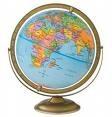
- Q3a three dimensional spherical scale model of the earthglobe30s
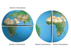
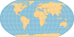
- Q4how the earth is divided into halveshemisphere30s
- Q5lines that measure distance north and south of the equatorlatitude30s
- Q6lines that measure distance east and west of the Prime Meridianlongitude30s
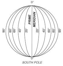
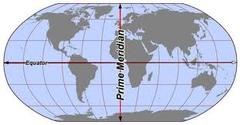
- Q7an imaginary line that runs through Greenwich, England and divides the earth into the eastern and western hemisphereprime meridian30s
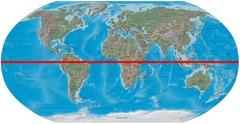
- Q8an imaginary line that runs through the middle of the earth and divides the earth into northern and southern hemisphereequator30s
- Q9different ways of showing the earth on a flat surfacemap projections30s
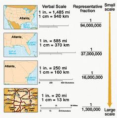
- Q10measures distance on a mapscale30s
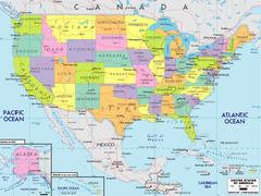
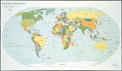
- Q11a type of map that shows cities, capitals, and land boundariespolitical map30s
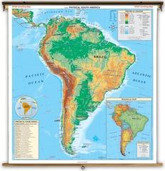
- Q12a type of map that shows landforms, water features, and elevationphysical map30s
- Q13a representation of a globe on a flat surfacemap30s