Loading...
Mod 26 MCQ Quiz
Quiz by Hannah Tapp Thomas
Tag the questions with any skills you have. Your dashboard will track each student's mastery of each skill.
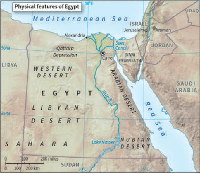
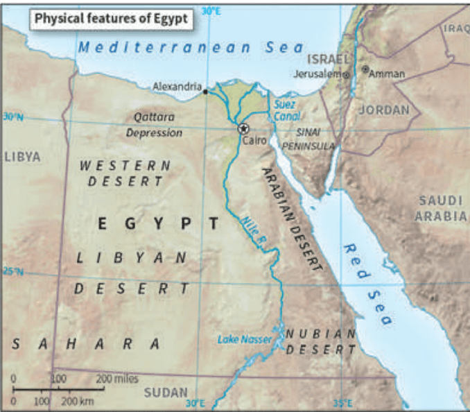
Which of the following describes how the physical features in Egypt provided protection for Cairo and the lush valley of the Nile River?
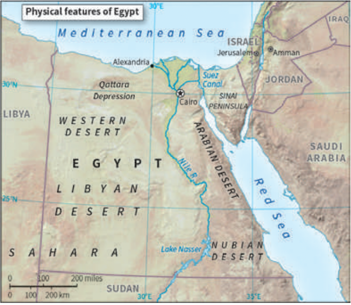
The sand from the surrounding deserts was used to build high fortifications that encircled Cairo and the valley of the Nile River.
The Qattara Depression was used to camou-flage military vehicles and armory.
The terrain features such as the deserts, river, and seas provided natural protection against invaders.
The water from the Nile was too rough for invaders to cross with horses or small boats.
The continuous sandstorms covered the build-ings in cities, acting effectively as natural camouflage.
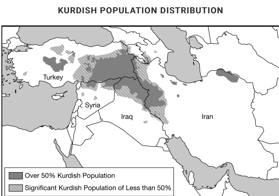
What is the scale of analysis on this map?
Global
Continent
Region
Country
Local
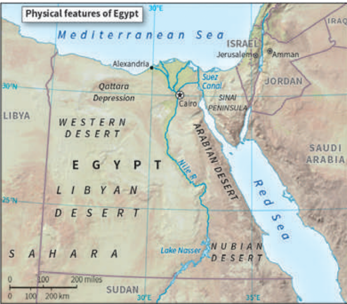
Which of the following describes how the physical features in Egypt provided protection for Cairo and the lush valley of the Nile River?
What is the scale of analysis on this map?
Which of the following concepts in political geogra-phy are depicted in the following image?

Which of the following explains a spatial relation-ship in a territorial force of devolution?
Which of the following best explains why the region of Catalonia in Spain could be a viable country?

Which of the following best represents the concept of the nation-state in its internal cultural-political makeup and spatial organization?
Which of the following countries did NOT have a significant, long-lasting colonial presence in Africa after 1920 ?
Based on the information in the map, what is the most likely outcome of the possible establishment of an independent Kurdistan for the Kurdish people?
Which of the following best explains the political pattern shown in the table?
