Loading...
Module 1: Introduction to Maps
Quiz by Hannah Thomas
Tag the questions with any skills you have. Your dashboard will track each student's mastery of each skill.
A formal region defines an area in which
Which of the following is the primary assumption of environmental determinism?
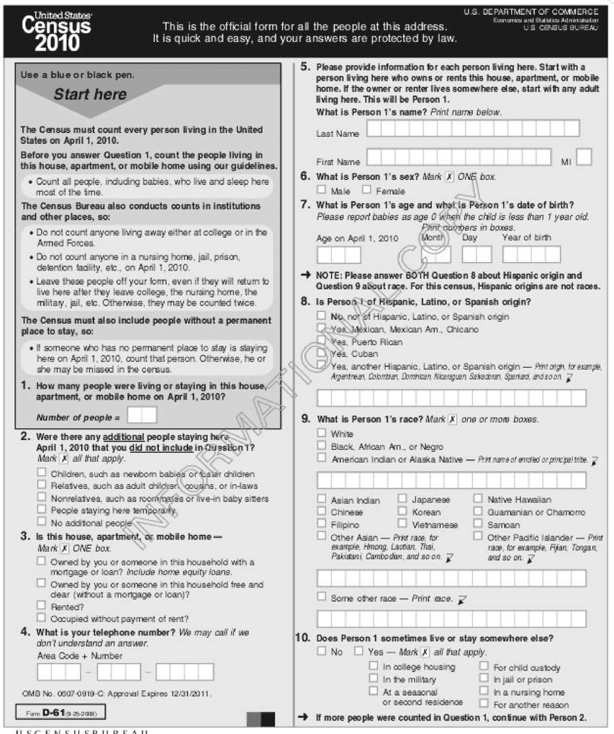
A political polling company wants to use census data to collect information on voters in a city by neighborhood. Based on the types of information collected in the survey form, which of the following could be mapped using census data?
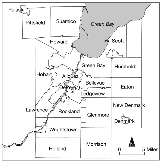
Which of the following scales of analysis would provide demographic data that could be used to compare one urban neighborhood to other urban neighborhoods across a country?
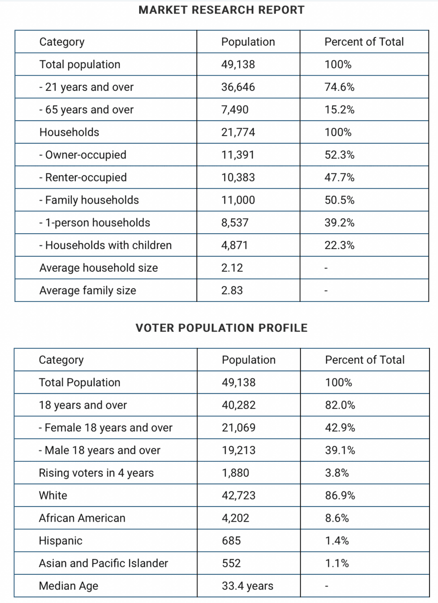
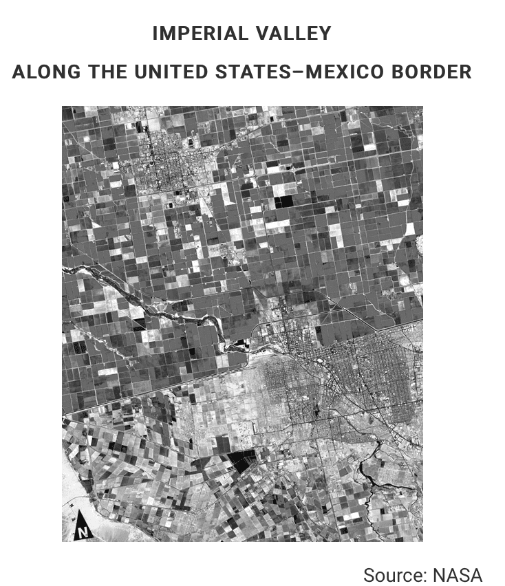
Market research reports and profiles of voting districts like those shown are examples of spatial analysis products. Which of the following data sources is most frequently used to create the spatial analysis products shown in the examples?
In descriptions of interaction between people and the environment, the term “environmental determinism” implies that
Which of the following describes the perspective of environmental determinism?
Which of the following terms best describes regions that make up the political geographic divisions within a country?
A formal culture region differs from other regions in that it
Read the definitions below and then answer the question that follows.
Watershed: A region in which all rainfall eventually flows downhill through a system of streams and tributaries into the same body of water, such as the catchment basin of a river or lake.
Milkshed: A region in which fresh milk is produced and can be delivered without spoilage for sale and consumption. A dairy farm sits at the center of an area, the size of which is determined by how far fresh milk can be shipped and still maintain shelf-life for consumers.
Given the definitions, watersheds and milksheds can best be classified as what type of region?
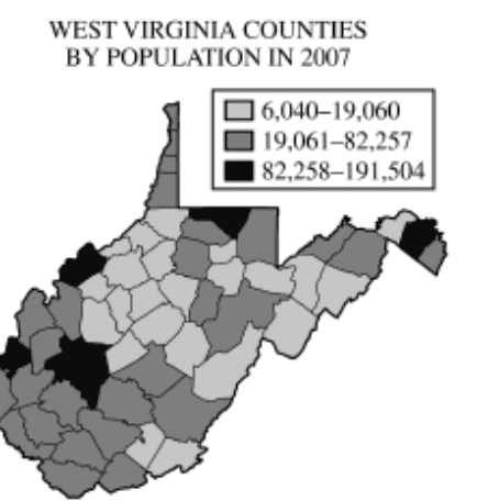
Which of the following scales is represented in the map shown?
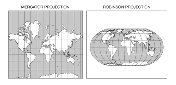
The map represents what kind of projection?
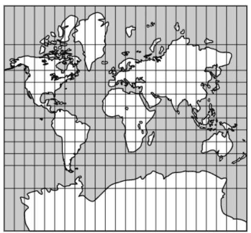
Every map projection has some degree of distortion because
Compare the 2 maps, then answer the following question.
Which of the following statements about the Robinson projection is correct?
Which of the following best identifies the scale of analysis for each of the maps shown?

The map best fits which of the following map types?
Twenty-four specific objects transmit complex radio codes, including time signals traveling at the speed of light. You can contact at least 4 of the 24 objects at any time of day or night.
The lush golf courses in the United Arab Emirates, the dikes and polders in the Netherlands, and the Three Gorges Dam in China are significant examples of land use.
These examples reflect which of the following viewpoints of human-environment interaction?
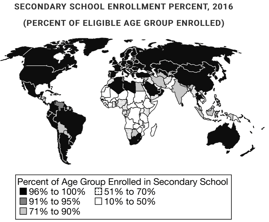
Which of the following best describes the data presented in the image?
Which of the following spatial patterns accurately describes the data presented in the map?
The concept of environmental sustainability is best explained by which of the following examples?
Latitude and longitude may be used to determine which of the following characteristics of a place?
Which of the following are the best examples of vernacular regions?