Loading...


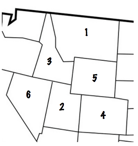
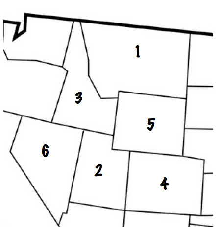
Mountain West Region Test
Quiz by Michelle Kruse
Customize this quiz to suit your class
Instantly translate to 100+ languages
Tag the questions with any skills you have. Your dashboard will track each student's mastery of each skill.
Give this quiz to my class
 Growing up in Sioux Falls, South Dakota, a small city surrounded by endless plains, I've found unexpected echoes of home in China's smaller towns — from the warmth of locals in Huaihua, Central China's Hunan province, to the quiet charm of Yangshuo, South China's Guangxi Zhuang autonomous region. With an itch to see more of China's lesser-visited regions, I began planning a trip to the northwest with seven friends — five Americans, one Pakistani, one Zimbabwean, and one Colombian. We bought round-trip tickets from Shanghai to Yinchuan, Ningxia Hui autonomous region, for less than $120 each. From there, we planned to rent a car and drive to Xining in Qinghai, then on to Qinghai Lake, and finally to Lanzhou, Gansu. To make that possible, several of us applied for Chinese driver's licenses, a process that involved translating our US licenses into Mandarin and passing a short test on traffic laws. Within a day, we were licensed. As we piled into two rental cars in late March to begin our eight-day journey, it became clear that this wasn't just a road trip — it was the culmination of our four years in China, the Mandarin we had so diligently studied, and our ongoing effort to contribute to US-China people-to-people relations. Right away, we drew curious reactions. At the Yinchuan airport, taxi drivers offered us rides into the city, only to stare in astonishment when we told them we had rented cars. "You're driving? In China?" one driver asked, visibly surprised. It was a reaction we'd encountered multiple times during our trip, as foreign drivers are rare in China, especially in remote regions. In Yinchuan, we stocked up on snacks and adjusted to the chilly desert air. From there, we headed west, navigating wide highways framed by dramatic landscapes: arid plains, jagged mountains, and occasionally, a herd of sheep crossing the road. The vastness of the Northwest was humbling — and as someone who grew up on the wide-open prairies of South Dakota, it felt oddly familiar. One of the highlights of our trip was camping by Qinghai Lake, the largest saltwater lake in China. A few summers ago, Santiago Solano, one of my classmates from the US, cycled from Xi'an in Shaanxi to Urumqi in the Xinjiang Uygur autonomous region over the course of a month and met many kind strangers along the way. One of them was Geng San, a Tibetan lamb herder who managed a piece of land right next to Qinghai Lake and graciously invited us to camp there. "That's what China is — it's the people. The quiet generosity of an old Tibetan nomad who, years after we first met, still offered us a place to rest on his land," said Solano, who is also part of the group on this trip. But apparently, we underestimated just how cold it would be to camp next to Qinghai Lake in late March. It was deathly freezing. In preparation for the trip, we had ordered two tent kits and eight sleeping bags. However, when the temperature eventually dropped to — 10 C, all of us piled into the cars and turned the heaters on. So much for camping. From Qinghai Lake, we drove to Lanzhou, where we visited many food markets and tried every type of noodle on offer. Since we are college students, we rented a gaming hotel room — something I've only ever seen in China. At night, instead of attending local parties as we had before, we stayed in the hotel and gamed late into the morning. For me, the trip was as much about the journey as it was about the destinations. Driving through Northwest China gave us a unique perspective on the region's natural beauty and its people. At gas stations, shopkeepers greeted us with curiosity and kindness, often offering recommendations for nearby attractions. At roadside carts, we sampled local specialties, grabbing a quick skewer and a mango for the road. And at every stop, we were touched by the warmth and hospitality that make traveling in China so rewarding. As an American who has lived in China for several years, I'm often asked about my experiences here. Trips like this one remind me of the similarities between the two countries, despite their differences. Just as road trips are a quintessential part of American culture, they've become my favorite way to explore China. Whether it's driving through the rolling hills of South Dakota or the deserts of Ningxia, there's something universal about the freedom and camaraderie that come with having complete control over where you end up. Written by Charlie Howes, a 22-year-old American who has lived in China since 2019. He completed his final year of high school at Beijing No 80 High School and is currently studying at New York University Shanghai. He has founded a company in China focused on facilitating US-China trade and plans to continue living in Shanghai long term. He enjoys road trips, cycling around the world, learning languages, and meeting new people.Southeast Asia, vast region of Asia situated east of the Indian subcontinent and south of China. It consists of two dissimilar portions: a continental projection (commonly called mainland Southeast Asia) and a string of archipelagoes to the south and east of the mainland (insular Southeast Asia). Extending some 700 miles (1,100 km) southward from the mainland into insular Southeast Asia is the Malay Peninsula; this peninsula structurally is part of the mainland, but it also shares many ecological and cultural affinities with the surrounding islands and thus functions as a bridge between the two regions. Mainland Southeast Asia is divided into the countries of Cambodia, Laos, Myanmar (Burma), Thailand, Vietnam, and the small city-state of Singapore at the southern tip of the Malay Peninsula; Cambodia, Laos, and Vietnam, which occupy the eastern portion of the mainland, often are collectively called the Indochinese Peninsula. Malaysia is both mainland and insular, with a western portion on the Malay Peninsula and an eastern part on the island of Borneo. Except for the small sultanate of Brunei (also on Borneo), the remainder of insular Southeast Asia consists of the archipelagic nations of Indonesia and the Philippines. Southeast Asia stretches some 4,000 miles at its greatest extent (roughly from northwest to southeast) and encompasses some 5,000,000 square miles (13,000,000 square km) of land and sea, of which about 1,736,000 square miles is land. Mount Hkakabo in northern Myanmar on the border with China, at 19,295 feet (5,881 meters), is the highest peak of mainland Southeast Asia. Although the modern nations of the region are sometimes thought of as being small, they are—with the exceptions of Singapore and Brunei—comparatively large. Indonesia, for example, is more than 3,000 miles from west to east (exceeding the west-east extent of the continental United States) and more than 1,000 miles from north to south; the area of Laos is only slightly smaller than that of the United Kingdom; and Myanmar is considerably larger than France. All of Southeast Asia falls within the tropical and subtropical climatic zones, and much of it receives considerable annual precipitation. It is subject to an extensive and regular monsoonal weather system (i.e., one in which the prevailing winds reverse direction every six months) that produces marked wet and dry periods in most of the region. Southeast Asia’s landscape is characterized by three intermingled physical elements: mountain ranges, plains and plateaus, and water in the form of both shallow seas and extensive drainage systems. Of these, the rivers probably have been of the greatest historical and cultural significance, for waterways have decisively shaped forms of settlement and agriculture, determined fundamental political and economic patterns, and helped define the nature of Southeast Asians’ worldview and distinctive cultural syncretism. It also has been of great importance that Southeast Asia, which is the most easily accessible tropical region in the world, lies strategically astride the sea passage between East Asia and the Middle Eastern–Mediterranean world. Within this broad outline, Southeast Asia is perhaps the most diverse region on Earth. The number of large and small ecological niches is more than matched by a staggering variety of economic, social, and cultural niches Southeast Asians have developed for themselves; hundreds of ethnic groups and languages have been identified. Under these circumstances, it often is difficult to keep in mind the region’s underlying unity, and it is understandable that Southeast Asia should so often be treated as a miscellaneous collection of cultures that simply do not quite fit anywhere else. Roofs of the Forbidden City, Beijing, China Britannica Quiz All About Asia Yet from ancient times Southeast Asia has been considered by its neighbors to be a region in its own right and not merely an extension of their own lands. The Chinese called it Nanyang and the Japanese Nan’yō, both names meaning “South Seas,” and South Asians used such terms as Suvarnabhūmi (Sanskrit: “Land of Gold”) to describe the area. Modern scholarship increasingly has yielded evidence of broad commonalities uniting the peoples of the region across time. Studies in historical linguistics, for example, have suggested that the vast majority of Southeast Asian languages—even many of those previously considered to have separate origins—either sprang from common roots or have been long and inseparably intertwined. Despite inevitable variation among societies, common views of gender, family structure, and social hierarchy and mobility may be discerned throughout mainland and insular Southeast Asia, and a broadly common commercial and cultural inheritance has continued to affect the entire region for several millennia. These and other commonalities have yet to produce a conscious or precise Southeast Asian identity, but they have given substance to the idea of Southeast Asia as a definable world region and have provided a framework for the comparative study of its components.hysical features of Southeast Asia The physiography of Southeast Asia has been formed to a large extent by the convergence of three of the Earth’s major crustal units: the Eurasian, Indian-Australian, and Pacific plates. The land has been subjected to a considerable amount of faulting, folding, uplifting, and volcanic activity over geologic time, and much of the region is mountainous. There are marked structural differences between the mainland and insular portions of the region. Mainland Southeast Asia The mainland is characterized by a series of generally north–south-trending mountain ranges separated by a number of major river valleys and their associated deltas. In many ways these ranges resemble ribs in a fan, where the interstices are deep trenches carved by the rivers. Although the mainland as a whole is similar in a structural sense, its various geologic components and the time periods of their orogenic (mountain-building) episodes differ. Much of the region has been affected by the gradual, continuing collision of the Indian subcontinent with the Eurasian Plate over roughly the past 50 million years, an event that—with diminishing intensity from west to east—has been responsible for deforming the land. Nonetheless, mainland Southeast Asia is relatively stable geologically, with no active or recently active volcanoes and, except in the northwest and north, little seismic activity. The ranges fan out southward from the southeastern corner of the Plateau of Tibet, where they are tightly spaced. A major rib of this system extends through the entire western margin of Myanmar (Burma); describing an elongated letter S, it consists of (from north to south) the Pātkai Range, Nāga Hills, Chin Hills, and Arakan Mountains. Farther to the south the same rib emerges from beneath the sea to become the Andaman and Nicobar Islands of India. Another major system extends along a straight north-south axis from eastern Myanmar east of the Salween River through northwestern Thailand to south of the Isthmus of Kra on the Malay Peninsula. It consists of a series of elongated blocks rather than one continuous ridge. The core of these blocks is granite, which has intruded into previously folded and faulted limestone and sandstone. The altitudes of the ranges diminish from above 8,000 feet (2,440 meters) on the Chinese border in the north to below 4,000 feet on the Isthmus of Kra, and the ranges are spread farther apart toward the south. The easternmost major mountain feature on the mainland is the Annamese Cordillera (Chaîne Annamitique) in Laos and Vietnam. In the portion between Laos and Vietnam, the chain forms a nearly straight spine of ranges from northwest to southeast, with a steep face rising from the South China Sea to the east and a more gradual slope to the west. The mountains thin out considerably south of Laos and become asymmetrical in form. The upland zone is characterized by a number of plateau remnants. The rather neat fanlike pattern of the mountain ranges is interrupted occasionally by several old blocks of strata that have been folded, faulted, and deeply dissected. These ancient massifs now form either low platforms or high plateaus. The westernmost of these, the Shan Plateau of eastern Myanmar, measures some 250 miles (400 km) from north to south and 75 miles from east to west and has an average elevation of about 3,000 feet. The largest of these features is the Korat Plateau in eastern Thailand and west-central Laos. This area actually is more of a low platform, which on average is only a few hundred feet above the floodplains of the surrounding rivers. It consists of a string of hills that direct surface drainage eastward to the Mekong River. The hills range in elevation from 500 to 2,000 feet, with the highest altitudes occurring near the southwestern rim. The broad river valleys between the uplands and the even wider deltas at the southernmost points contain most of the mainland’s lowland areas. These regions generally are covered with alluvial sediments that support much of the mainland’s cultivation and, in turn, most of its population centers. The most extensive coastal lowland is the lower Mekong basin, which encompasses most of Cambodia and southern Vietnam. The Cambodian portion is a broad, bowl-shaped area lying just above sea level, with numerous hill outcrops jutting above the landscape; at its center is a large freshwater lake, the Tonle Sap. To the south the river’s vast, flat delta occupies the entire southern tip of Vietnam. Outside the river deltas, the coastal lowlands are little more than narrow strips between the mountains and the sea, except around the southern half of the Malay Peninsula. The Malay Peninsula stretches south for some 900 miles from the head of the Gulf of Thailand (Siam) to Singapore and thus extends the mainland into insular Southeast Asia. The narrowest point, the Isthmus of Kra (about 40 miles wide), also roughly divides the peninsula into two parts: the long linear mountain ranges of the northern part described above give way just south of the isthmus to blocks of short, parallel ranges aligned north-south, so that the southern portion trends to the southeast and becomes much wider. In areas such as the west coast between southern Thailand and northwestern Malaysia, distinctive karst-limestone landscapes have developed. Peaks on the peninsula range from 5,000 to 7,000 feet in elevation.Continental Drift Theory. From the discussion of the rock cycle, it has been pointed out that through Earth's external and internal processes. Earth's surface is constantly changing. However, this idea of a changing environment did not conform with the belief of earlier scientists. Rather, they thought that the geographic positions of ocean basins and continents have been static since the beginning of time. It was around the 1500s when Leonardo da Vinci, upon his discovery of fossil seashells found at the high mountains of Italy, first thought of the idea that the areas where mountains are located may have been oceans in the past. Through time, other fossils of marine organisms found far above the current sea level further supported the idea that mountains were uplifted and weathering wore them down. At around the 1800s, most scientists have accepted the idea that Earth's crust is undergoing large vertical movements or uplifting. There was also evidence of possible horizontal movements, but the scientists then were not convinced about it. Alfred Wegener showed evidence of horizontal or lateral movement of the continents in his continental drift theory. According to him, the continents have drifted around the world and have once formed a giant landmass or supercontinent called Pangaea. To support his theory, Alfred Wegener presented a set of geographical, biological, and climatic evidence.Wegener's geographical evidence included the jigsaw puzzle fit of the current continents. He pointed out that the coastlines of South America and Africa seem to fit together. He also pointed the presence of mountain ranges having similar rock types and age but separated by vast oceans, like that of the folded rocks of the Caledonian mountains. The same folded rocks run through West Africa, North America, Newfoundland, Ireland, Wales, Scotland, Greenland, and Norway, all of which are now separated by the Atlantic Ocean. A geographical evidence on the similar rock types in West Africa, North America, Greenland, and Europe is found. The biological evidence came in the discovery of similar plant and animal fossils in different continents separated by oceans. The animal fossils of Mesosaurus and Lystrosaurus indicate that they were not capable of crossing the oceans to reach the other continents. If they were, the fossils should have been more widely distributed Africa, Australia, India, and South America were too large to be carried by wind. This indicates that the areas where the fossils were found were closely linked. It has also been found out that the plant only grew in areas with subpolar climate, which would indicate that the landmasses were located near the South Pole.Lastly, for his climatic evidence, Wegener discovered that a glacial period occurred during the late Paleozoic era in Southern Africa, South America, Australia, and India. The initial explanation for this event was global cooling, but it was rejected because large tropical swamps with so much vegetation were found at the same time in the Northern Hemisphere. This further supported the idea that the supercontinent was indeed near the South Pole, and the continents in Northern Hemisphere were once near the equator. The glacial period also left glacial striations, or the scratches glaciers make as they move across on the underlying bedrock, on the aforementioned continents. For such an event to happen, the continents would have to be connected. SCIENCE PIONEER. Alfred Wegener (1880-1930). Alfred Wegener was a German polar researcher, geophysicist, and meteorologist. He was known for his work on the continental drift theory. In his effort to defend his work, he went to the Greenland ice sheet where he died.Even with all the compelling evidence, the continental drift theory hardly convinced the scientific community at that time because Wegener was unable to identify a credible mechanism that drives the continental drift. He was unable to clearly explain how the continents moved and how the larger continents broke through the ocean floor. Eventually, critics of the continental drift began to accept the theory when new evidence supporting the theory was discovered. The new evidence led to a more encompassing theory the theory of plate tectonics. This theory provided a more convincing explanation as to how the continents moved. The evidence that paved the way for the theory of plate tectonics was the idea of wandering poles. Scientists began studying volcanic rocks to determine the location of the magnetic poles. When volcanic rocks crystallize, the minerals with magnetic properties align themselves parallel to Earth's magnetic field at the time the minerals were formed. This finding allowed scientists to determine the polarity of Earth's magnetic field and the magnetic inclination that showed the location of the poles. Upon studying the paleomagnetism of the rocks, geophysicists found out that rocks from various locations point to different magnetic north poles, suggesting that the poles have wandered. Since movement of magnetic poles is very unlikely, scientists have accepted the idea that the continents are indeed moving. And if the continents are moving, scientists thought that maybe the ocean basins are moving too. They also discovered that some rocks showed magnetic reversals, which led them to believe that the magnetic north pole now was not always the magnetic north pole. Seafloor Spreading. After World War II, exploration on the ocean floor became the focus of many geologic studies. It was only then that the ocean ridge system was discovered. A geologist in Princeton University named Harry Hess, along with other scientists, studied this ocean ridge system and hypothesized that the oceanic crust was moving away from the ridge. His hypothesis, known as seafloor spreading, showed that the ocean floor is split along the ridge where the magma rises to form the new ocean floor.Because of this, rocks located near the ridge are younger than those that are located magnetic polarity of Earth is also preserved in those rocks. Withe ridge scientists were able to see the magnetic reversals in the ocean floor, and they were able to make use of information to determine that the ocean floor is moving at a rate of about 10 cm per year. Plate Tectonics. Confirmation of the seafloor spreading hypothesis proved that continents are not moving above the ocean floor. Rather, it is the fragments of the lithosphere. The lithosphere is the rigid layer that is composed of the uppermost mantle and the crust that carry the continents and the ocean basins along. These fragments of the lithosphere are called plates. Underneath the lithosphere is a weaker region in the mantle known as asthenosphere that behaves like a fluid. Thus, the lithosphere floats above the asthenosphere, making it detached and free to move. This became the basis of the theory of plate tectonics. Now that it has been made clear that it is the plates which are moving, the question as to how they move remained. Sir Arthur Holmes proposed the driving force for this plate movement in 1919. He suggested that the movement in the mantle carries the plates along. It was previously discussed that Earth's interior is very hot due to the heat produced by radioactive decay. Convection takes place in the mantle, keeping the asthenosphere hot and weak. The convection currents produced in the asthenosphere are the ones carrying the lithospheric plates and making them move. However, convection currents are not enough. Mechanisms such as ridge push and slab pull aid the convection currents to slowly move the lithospheric plates. Ridge push occurs at mid ocean ridges which are higher in elevation than the surrounding trenches and abyssal plains. The new ocean floor from the ridge is hot and relatively thin. As it moves away from the ridge, it cools down and gets denser, heavier, and thicker. Below this cooling ocean floor is the asthenosphere, which is less dense. This area becomes a massive shear zone and the new ocean floor will effectively slide down the slope of the asthenosphere. When the plate collides with another plate with lesser density, the denser plate sinks and a subduction zone is formed. When the subducting plate sinks, it pulls on the rest of the plate behind it. These mechanisms explain the movement of the plates.Earth has seven major lithospheric plates that account for 94% of Earth's surface. These are the North American Plate, South American Plate, Pacific Plate, African Plate, Eurasian Plate, Indo-Australian Plate, and Antarctic Plate. These plates are constantly moving relative to the other plates. Thus, the interaction of plates occurs mostly along the boundaries. These movements are plotted using information from earthquakes and volcanic activities. There are three main types of plate boundaries: convergent, divergent, and transform boundaries Convergent boundaries are boundaries where two plates move towards each other A convergent boundary is also known as destructive margin since this is where the collision between two plates occhins. There are three types of convergence-oceanic oceanic, oceanic-continental, and continental-continental. Trenches are features of the ocean floor that are present in both oceanic-oceanic boundary and oceanic-continental boundary. Subduction occurs at the trenches, therefore, these are characterized as the deepest parts of Earth. A divergent boundary is the opposite of convergent boundary: two plates move away from each other. Divergent boundaries create new crust; thus, they are also known as constructive margins. The ocean ridge system is a divergent boundary where new ocean floor is produced as magma rises, pushing the older rocks aside.Transform boundary is also known as conservative plate margin since two plates just move past one another, neither creating nor destroying land. Earthquake epicenters are usually detected at transform boundaries because the rocks tend to break and not fold or sink, like in convergent boundaries. Evolution of the Ocean Basins. Both the movement of the plates and seafloor are responsible for the evolution of ocean basins. Along the divergent boundary where ocean ridge systems are found, magma is released and new ocean floor is created. Along convergent boundaries, the ocean floor is being destroyed. The evolution of the ocean basins started during the time when Pangaea was still present and was surrounded by the vast ocean or superocean known as Panthalassa, also called Paleo-Pacific or "old Pacific." Upon the initial break up of Pangaea into Laurasia and Gondwanaland, the Tethys Sea began to form. Then, the Eurasian and North about, forming the North Atlantic. The South Atlantic only started to form when the African Plate and South American Plate separated. The continued movement of the plates created the Himalayas at one side and separated the Pacific Ocean and Atlantic Ocean at the other side, which consequently formed the current ocean basins. Both the movement of the plates and seafloor are responsible for the evolution of ocean basins. Along the divergent boundary where ocean ridge systems are found, magma is released and new ocean floor is created. Along convergent boundaries, the ocean floor is being destroyed. The evolution of the ocean basins started during the time when Pangaea was still present and was surrounded by the vast ocean or superocean known as Panthalassa, also called Paleo-Pacific or "old Pacific." Upon the initial break up of Pangaea into Laurasia and Gondwanaland, the Tethys Sea began to form. Then, the Eurasian and North about, forming the North Atlantic. The South Atlantic only started to form when the African Plate and South American Plate separated. The continued movement of the plates created the Himalayas at one side and separated the Pacific Ocean and Atlantic Ocean at the other side, which consequently formed the current ocean basins.Continents do not immediately end at the point where the ocean meets the land. They may extend slightly into the oceans. The portion of the continent that is submerged is called continental margin. There are two types of continental margin: passive margin and active margin. A passive continental margin consists of a continental shelf, continental slope, and continental rise. It is not associated with plate boundaries; thus, there are very little tectonic activities. An active continental margin only has a continental shelf and a continental slope. It is associated with plate boundaries; thus, a main feature of this boundary is a trench. The different features of a continental margin are the following: 1. The continental shelf is the gently-sloping submerged portion of the continent. 2. The continental slope is the steep slope after the continental shelf. It is still part of the continent. 3. The continental rise is the gently-sloping area after the continental slope and before the ocean floor. 4. The trenches are the deepest parts of the ocean. These are narrow depressions caused by the subduction of the ocean floor along the convergent boundaries. 5. The mid-oceanic ridge is the mountain range system in the ocean. It is responsible for the production of new ocean floor. This is the region where new magma constantly emerges from. SCIENCE CAREER. A scientific illustrator uses art to inform and communicate complex details and concepts of science. He/She makes use of scientifically informed observations and research along with his/her technical art and aesthetic skills to make accurate representations. In Natural History, the scientific illustrators recreate how the extinct species look like by working with scientists and fossil records. Moreover, with the advances in technology, illustrators are now into 3D modelling, animation, and video making. Earth's History. All the processes that have been discussed require long periods of time to create a noticeable change on Earth's surface. You can just imagine how long it would take to create an oceanas vast as the Pacific Ocean if the ocean floor moves only at about 10 cm/year. It is then important to know the history of Earth to learn the complexities of its past and be able to use it to understand the present. Just like learning the history of a country that requires one to read a lot of books, learning the history of Earth involves studying a lot of rocks. Rocks, especially sedimentary rocks, contain a lot of information about Earth's past. It holds the key to most of the geologic processes that happened on Earth and the key to uncovering how life on Earth evolved. But these discoveries are worthless if there is no time perspective. Thus, one of the most important contributions of geologists to mankind is the geologic time scale, which holds a history that is exceedingly long.Chapter 8: The Worlds of North and South Geography Geography refers to the seasons, climate, soil, and physical features of a region (mountains, rivers, etc.) The differences in geography b/t the N and S is one of the major reasons slavery b/c entrenched in the S while it died out in the N. Geography of the North The N has diverse geography and experiences four distinct seasons including long, harsh winters. The Great Plains region has some of the best farmland in the country. New England has rocky, hilly wilderness, not well suited for farming. It has hundreds of bays and harbors along its coastline. States farther S had rich soil and coastal access through rivers. The N also experienced mass deforestation b/c of the need for lumber and to make room for farms. Geography of the South Climate: the S had mild winters, and a long, hot, humid growing season. It has fertile lowlands, marshes and swamps. It's ideal for growing tobacco, sugar, rice, indigo, and cotton (cash crops). B/c of the geography of the S, their whole way of life was based on agriculture and geography is one of the major reasons why slavery took off in the S. Economies Economy basically refers to the way people make and spend money. The Northern economy was far more diversified than the Southern. Economy of the North The North experienced the Industrial Revolution—the shift from handmade goods to machine-made goods. This resulted in new jobs, increased production, and improved efficiency in agriculture. IOW, you can make things faster, easier, and cheaper. More ppl get more stuff. Factories were almost always located next to rivers. The Reaper The Indust. Rev. changed northern agriculture with Cyrus McCormick’s reaper. It could cut 28xs more grain than a single man. The Sewing Machine Elias Howe's sewing machine; At 250 stitches a minute, Howe's lockstitch mechanism out-stitched the output of five hand seamstresses with a reputation for speed, completing in one hour what took the sewers 14.5 hours. The Textile Mill Francis Cabot Lowell's textile mill: essentially the first factory in the US, Lowell set the model for all future factories. Interchangeable Parts Eli Whitney's interchangeable parts; considered the "dawning of a new age" of machinery. This concept was applied to pretty much all manufacturing. Economy of the South The South's economy was based on AGRICULTURE. Most southerners were agrarians. Most had small farms, some owned plantations. Slavery beginning to decline in late 1700s; prices went down (tobacco, indigo) and cotton was difficult. King Cotton Cotton was South’s most important crop. Earned more money than all other exports combined. The S would go on to supply 75% of the world's cotton demand. Cotton Gin Eli Whitney invented the cotton gin in 1794 and forever changed the US. The gin made cotton incredibly profitable. We start to see the effects of the cotton gin around 1820. Slavery and Cotton Southerners put all their money into slaves and land, and almost none into building factories. With the spread of cotton, demand for slaves increased. 1790 to 1850, number of slaves rose 600%. Transportation Again, the N was far more inventive in their approach to transportation than the S. Transportation in the North National Road National Road stretched from the East (the Potomac), over the Appalachians, to the West (Illinois), over 620 miles. Steamboat In 1807, Robert Fulton invented the steamboat. It traveled 150 miles UP the Hudson River at a speed of 5 mph. Erie Canal Built b/t 1817 and 1825, the canal spanned 363 miles and connected Lake Erie to the Hudson River. This connected farms in the W to cities in the E and the Atlantic Ocean. Clipper Ship Clippers were narrow w massive sails that were built for speed. They cut the time it took to cross the Atlantic in half. Locomotive The fastest and cheapest way to move goods was by steam-powered trains. The first RR was the B&O which was built in 1827. Transportation in the South Most people and goods in the South traveled by rivers in steamboats. The South had trains, but less than half the amount of railroad track than the North had. Society (The People) The people who made up the N and S could not have been more different. The S was primarily agrarian while the N was b/c urbanized. The S was holding on to the past, while the N was embracing change. Society in the South Society was organized into 3 distinct classes of people: rich plantation owners at the top; then white farmers and workers; slaves on the bottom. This rigid social class system was the result of a slave-based agricultural system. Power Structure Only 1 in 4 whites owned a slave. Plantation owners, who owned more than 20 slaves, dominated politics and the economy. Society in the North 7 of 10 Northerners still lived on farms by the 1840s (6 of 10 by 1860), but urbanization was growing fast in the N. The N relied on wage labor as opposed to slave labor, so most blacks in the N were free. N blacks were not treated equally and the N was about as racist as the S. Immigration Compared to the S, the N population was exploding, in large part bc of immigration. Between 1845 and 1860, 4 million immigrants came to the North. Most were German and Irish. Irish--a potato famine; German--a failed revolution. Ethnic neighborhoods developed as a result.Journey to the West 79: The Mountain of Flames (단어) STUDYJourney to the West 72: A Surprise at the Fruit and Flower Mountain (단어)Determine author's purpose, techniques, tone and mood using this stimulus And so the three mail planes from Patagonia,1 Chile and Paraguay were returning from the South, the West and the North to Buenos Aires. Their cargo was awaited there so that the plane for Europe could take off, around midnight. Three pilots, each behind an engine casing heavy as a barge, lost in the night, were contemplating their flight and, approaching the immense city, would descend slowly out of their stormy or calm sky, like strange peasants descending from their mountain. Rivière, who was responsible for the entire operation, was pacing up and down on the Buenos Aires landing-ground. He remained silent, for until the three planes had arrived, the day held a sense of foreboding for him. Minute by minute, as the telegrams reached him, Rivière was conscious that he was snatching something from fate, gradually reducing the unknown, hauling in his crews out of the night, towards the shore. One of the men came up to Rivière to give him a radioed message: Chile mail reports that he can see the lights of Buenos Aires. Good. Before long, Rivière would hear this plane; already the night was surrendering one of them, just as a sea, swollen with ebbing and flowing and mysteries, surrenders to the shore the treasure it has tossed around for such a long time. And later on, it would give back the other two. Then this day’s work would be over. Then the worn-out crews would go and sleep, to be replaced by fresh crews. But Rivière would have no rest: the mail from Europe, in its turn, would fill him with apprehension. And so it would always be. Always.