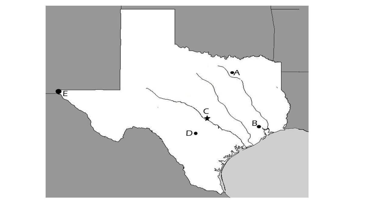
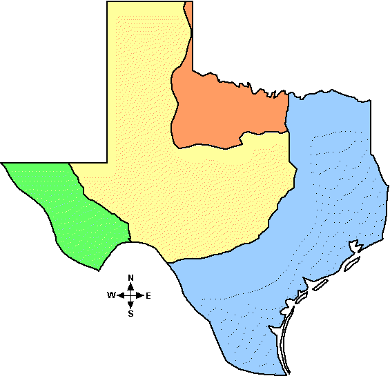
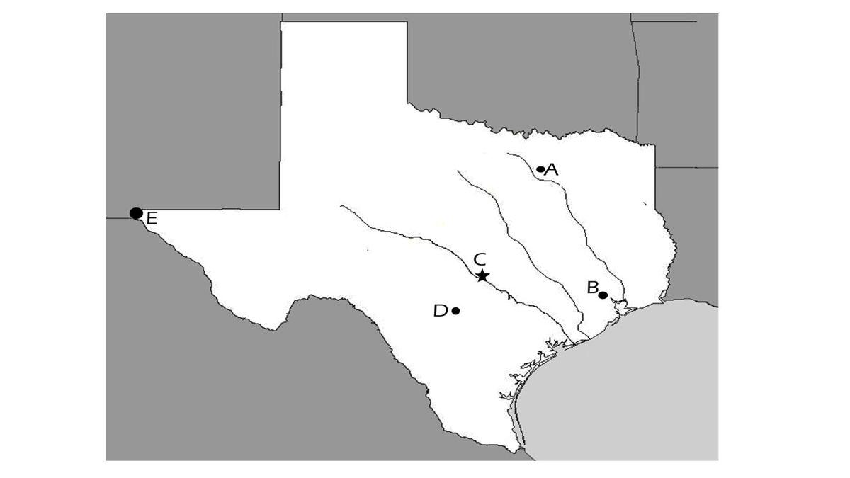
Locate the Mountains and Basins, Great Plains, North Central Plains, and Coastal Plains regions and places of importance in Texas during the 19th, 20th, and 21st centuries such as major cities, rivers, natural and historic landmarks, political and cultural regions, and local points of interest;
Identify the major eras in Texas history, describe their defining characteristics, and explain why historians divide the past into eras, including Natural Texas and its People; Age of Contact; Spanish Colonial; Mexican National; Revolution and Republic; Early Statehood; Texas in the Civil War and Reconstruction; Cotton, Cattle, and Railroads; Age of Oil; Texas in the Great Depression and World War II; Civil Rights and Conservatism; and Contemporary Texas;
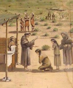
Identify important events and issues related to European colonization of Texas, including the establishment of Catholic missions, towns, and ranches, and individuals such as Fray Damián Massanet, José de Escandón, Antonio Margil de Jesús, and Francisco Hidalgo;
Identify important individuals, events, and issues related to European exploration of Texas such as Alonso Álvarez de Pineda, Álvar Núñez Cabeza de Vaca and his writings, the search for gold, and the conflicting territorial claims between France and Spain;
Analyze the effects of physical and human factors such as climate, weather, landforms, irrigation, transportation, and communication on major events in Texas.
Compare the cultures of American Indians in Texas prior to European colonization such as Gulf, Plains, Puebloan, and Southeastern;
Identify examples of Spanish influence and the influence of other cultures on Texas such as place names, vocabulary, religion, architecture, food, and the arts;
Compare places and regions of Texas in terms of physical and human characteristics;
Explain the significance of the following dates: 1519, mapping of the Texas coast and first mainland Spanish settlement; 1718, founding of San Antonio; 1821, independence from Spain; 1836, Texas independence; 1845, annexation; 1861, Civil War begins; 1876, adoption of current state constitution; and 1901, discovery of oil at Spindletop.
Organize and interpret information from outlines, reports, databases, and visuals, including graphs, charts, timelines, and maps;
Track each student's skills and progress in your Mastery dashboards