Loading...
QC EXAM AUGUST 2025
Quiz by Mark Lester Diacos
Tag the questions with any skills you have. Your dashboard will track each student's mastery of each skill.
Construction Speed Limit End when the sign stops to propagate due to the following:
How should electric speed signs be handled in terms of determining the legal speed in Drivable Paths (DPs)?
When should the confidence value of 4 (from electric speed signs) end?
In a case where there is an explicit 100 speed sign on both sides of the road and an overhead electric 130 sign, how should this be handled?
When should Confidence 5 (Map Edge) be applied to a Drivable Path (DP)?
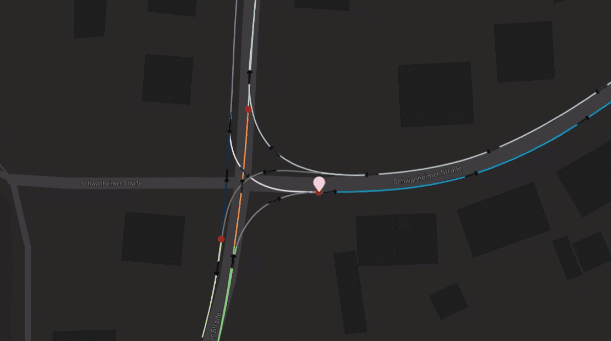
You encounter a Drivable Path (DP) that appears to begin abruptly near a roundabout (RA), with no prior DP connected to it. There’s no clear indication it was cut in the middle. How should this be handled?

In a Map Edge scenario, if there is a speed limit sign immediately after the edge, how should it be handled?
When should Confidence 6 (School Zone) be applied?
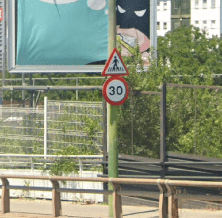
A speed limit sign shows "50 km/h 22:00–06:00" and the road's legal speed is 70 km/h. How should this be tagged?
How long should the secondary speed (weather-based) continue?
When should Confidence 8 be used?
You see two disconnected DPs on either side of a highway facility, and they do not align or appear to be part of a continuous path. Should this be tagged as a DP hole?

Which of the following best describes a true Map Edge situation?
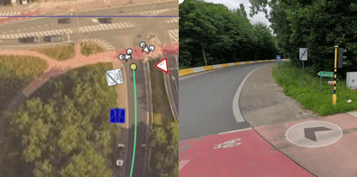
You see a construction speed sign in Google Maps, but MapMarker does not show it, and the image dates do not match. What should you do?
You are analyzing a road near a HWX with no signs indicating the speed limit. However, according to the rules page, in built-up areas, roads with two or more lanes per direction have a default speed of 50. How should you tag the speed in this case?
When does the speed bump speed zone end, according to client rules?
Another case involves a 20 Zone, but there is a map edge within the road. According to the map edge rules, the speed should be set to LS 50 based on the road type, as specified in the Legal Speed rules for Germany. Can we still use LS 20, even if it is not stated on the rules page?

When a DP starts out of nowhere and the nearest speed sign prior to the map edge can be used to determine speed, but the sign is not detected by the Map Marker. How should this case be treated?

When a speed limit sign is placed on the same pole as a warning sign (e.g., for a roundabout), how should the speed be treated after the warning condition ends?
When we encounter a case where MM detects a Legal Speed (LS) of 35, but Google Maps (GM) shows an undetected LS 25 School Zone sign. There is also a detected "End of School Zone" sign at the end of the road, and the other side of the road has a detected LS 25 School Zone. What speed should be applied in this case?

We encounter a road in Milan (Italy) where an “End of Zone 30” sign is present, but there are no visible “Zone 30” signs at any of the entrances or access points. What should be the correct speed limit applied?
A “Zone30 creates a slow road type, in which the speed propagates until EndOfZone. However, the rules page does not list LS 30 as a road type speed the lowest indicated is LS 50. What should you do?

In Spain a case where the road type was prioritized over speed propagation. There's a rule about excluding certain lanes when determining lane count. Which of the following is true?
In the Netherlands, if you encounter an LS 60 explicit sign along with other signs related to school zones, how should it be tagged according to the LS Rules?

Annotating a road that starts at a map edge, and just after the map edge, there is an "End of Zone 30" sign visible. The beginning of the Zone 30. According to the guidelines for Germany, the default speed based on road type is LS 50. What should be the correct Legal Speed (LS) before the "End of Zone 30" sign?

Which of the examples is a case of DP hole "Bad DP"?
What should you do if an AIP repeatedly makes the same tagging error despite prior feedback?
If the rules do not clearly state how to handle a specific tagging case, what is the best course of action?
How should a QC respond when they realize they made an error in their review after submission?
A new rule has been implemented, but many AIPs are still using the old one. What should you do?
RST
A specific area or region designated for a particular purpose or use, based on zoning laws or regulations. It could refer to residential, commercial, industrial, or other types of areas in a city or town. What is this called?
RST
When you are not sure which road type matches the road, how should it be tagged?
RST
A _________ is a designated area within a city or municipality that is reserved primarily for housing. Zoning laws regulate these areas to ensure they are used mainly for residential purposes, such as single-family homes, apartments, or other dwellings, and to limit industrial or commercial activity that could disrupt the living environment.
RST
Refers to travel or transportation between cities or towns. It describes roads, trains, or systems that connect urban areas over long distances, often between two or more cities.
RST
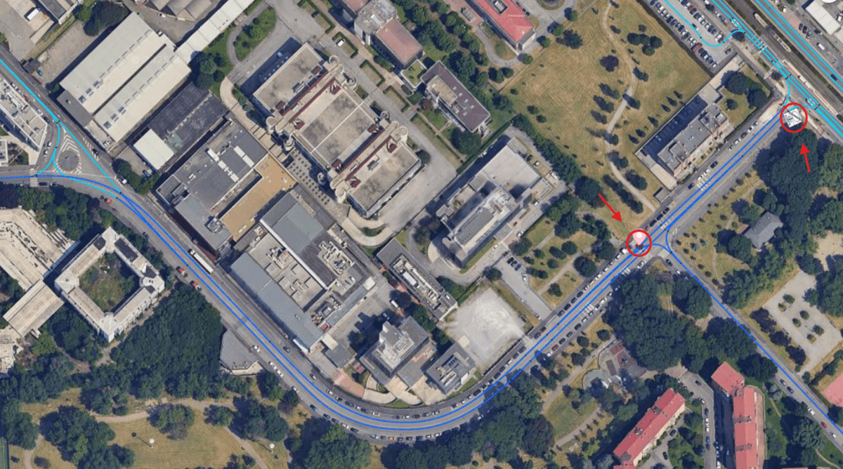
Refers to areas characterized by higher population density and extensive human-made features compared to surrounding areas. These typically include cities and towns with developed infrastructure such as roads, buildings, transportation systems, and public services. Changing the road subtype to this does not require a sign, as long as there is a clearly populated area and a junction.
A wide, fast road designed for high-speed traffic, with no stoplights and limited entry and exit points. It is built to help vehicles travel quickly between cities or different parts of a city.
A high-speed road designed for long-distance travel, usually with multiple lanes, no traffic lights, and no pedestrians or bicycles allowed. It is similar to an expressway or freeway.
This sign indicates that you are now entering a built-up area, where there are houses, establishments, and other signs of concentrated human activity. Such areas typically have lower speed limits, increased pedestrian activity, and more traffic control measures.
This sign indicates that you are now leaving a built-up area, where there are houses, establishments, and other signs of concentrated human activity. Beyond this point, speed limits may increase, pedestrian activity is reduced, and traffic control measures may be less frequent.
This sign indicates that you are now entering a highway or motorway. These roads are designed for high-speed, long-distance travel, typically with multiple lanes, no traffic lights, and controlled entry and exit points. Pedestrians, bicycles, and certain slow-moving vehicles are usually prohibited. Speed limits are generally higher, and lane discipline is strictly enforced.
This sign indicates that you are leaving a highway or motorway. After passing this point, the road will typically have lower speed limits, potential intersections, traffic lights, pedestrian crossings, and access for bicycles or slower vehicles. Drivers should be prepared for increased traffic interaction, fewer lanes, and changes in road conditions.
If two speed limit signs are detected in Map Marker (MM) for the same location, which sign should be applied?

If an LS Zone 15 sign is not listed in the Road Sign Table (RST) attribute or in the signs page, how should it be treated during annotation?
When verifying an area with a toll, you notice there may also be an establishment within it, suggesting the area could be urban. How should this situation be handled?

If there is an undetected sign in an area for example, a Zone 30 sign that MM does not detect but is visible in Google Maps (GM). how should you tag this case?

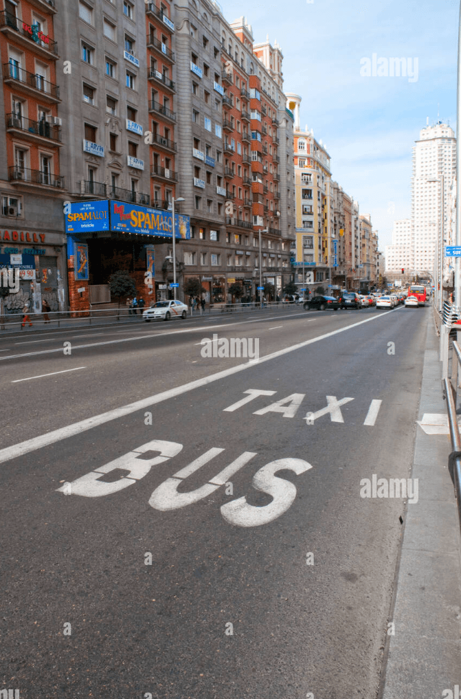
Main Road
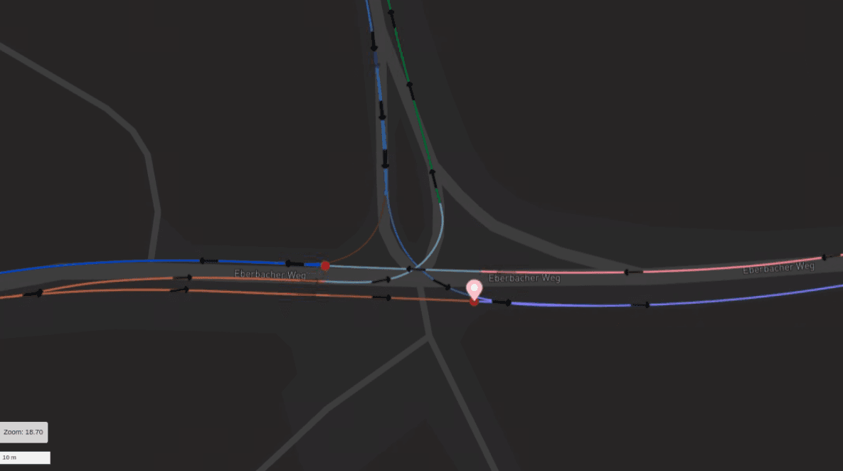
What will be the tag for this event?
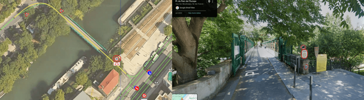
Main Road
What will be the tag for this event?
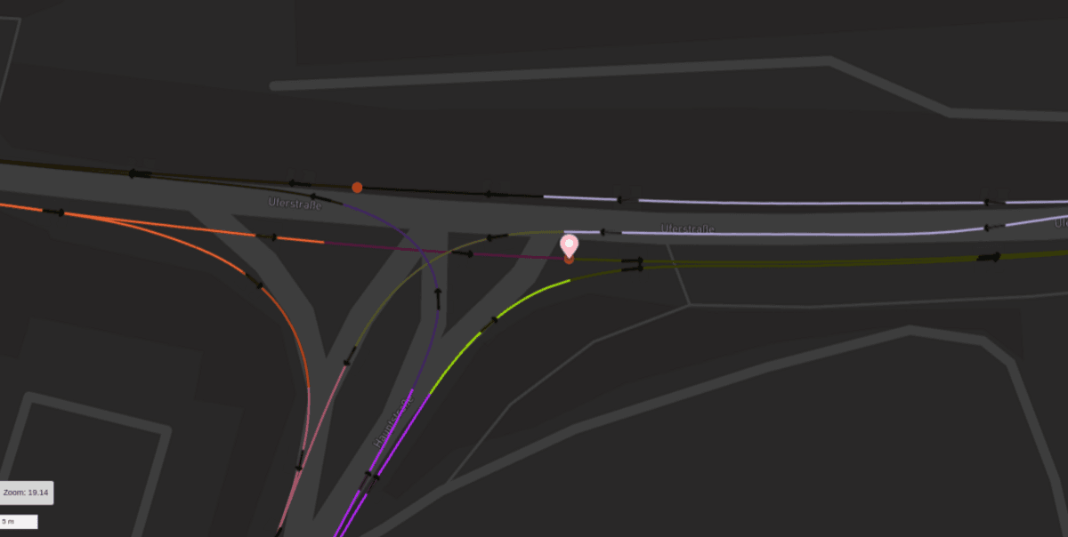
Main Road
What will be the tag for this event?
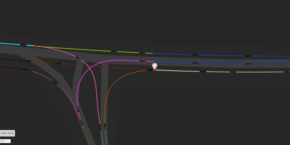
Main Road
What will be the tag for this event?

Main Road
What will be tag for this event?