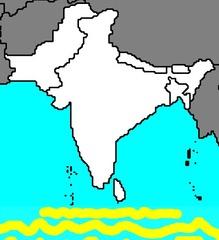
South Asia: Map & Facts
Quiz by John Hagenmaier
Feel free to use or edit a copy
includes Teacher and Student dashboards
Measure skillsfrom any curriculum
Measure skills
from any curriculum
Tag the questions with any skills you have. Your dashboard will track each student's mastery of each skill.
With a free account, teachers can
- edit the questions
- save a copy for later
- start a class game
- automatically assign follow-up activities based on students’ scores
- assign as homework
- share a link with colleagues
- print as a bubble sheet
54 questions
Show answers
- Q1See imagePacific OceanArabian SeaIndian OceanBay of Bengal30s
- Q2.... blocks the cold air from China from getting into IndiaHimalayasDMXGanges Riv erBay of Bengal30s
- Q31100 short, sandy islandsMaldives30s
- Q4See imageNepalBhutanBangladeshSri Lanka30s
- Q5See imageIndiaPakistanNepalSri Lanka30s
- Q6See imageIrawaddy RiverGanges RiverIndus RiverBrahmaputra River30s
- Q7See imageGanges RiverIndus RiverRed RiverBrahmaputra River30s
- Q8See imageIndia FlagSri Lanka FlagBhutan FlagMaldives Flag30s
- Q9See imagePakistan FlagNepal FlagAfghanistan FlagBhutan Flag30s
- Q10See imageNepal FlagBangladesh FlagBhutan FlagSri Lanka Flag30s
- Q11See imagePakistan FlagIndia FlagNepal FlagAfghanistan Flag30s
- Q12See imageBhutan FlagSri Lanka FlagAfghanistan FlagMaldives Flag30s
- Q13See imageMaldives FlagPakistan FlagSri Lanka FlagAfghanistan Flag30s
- Q14See imageAfghanistan FlagBhutan FlagBangladesh FlagNepal Flag30s
- Q15over 29,000 ft above sea level!Mt McKinleyMt. EverestKilimanjaroMt Fuji30s
