Loading...
Studies Weekly Week 2 Assessment
Quiz by SYDNEY GUTIERREZ
Tag the questions with any skills you have. Your dashboard will track each student's mastery of each skill.
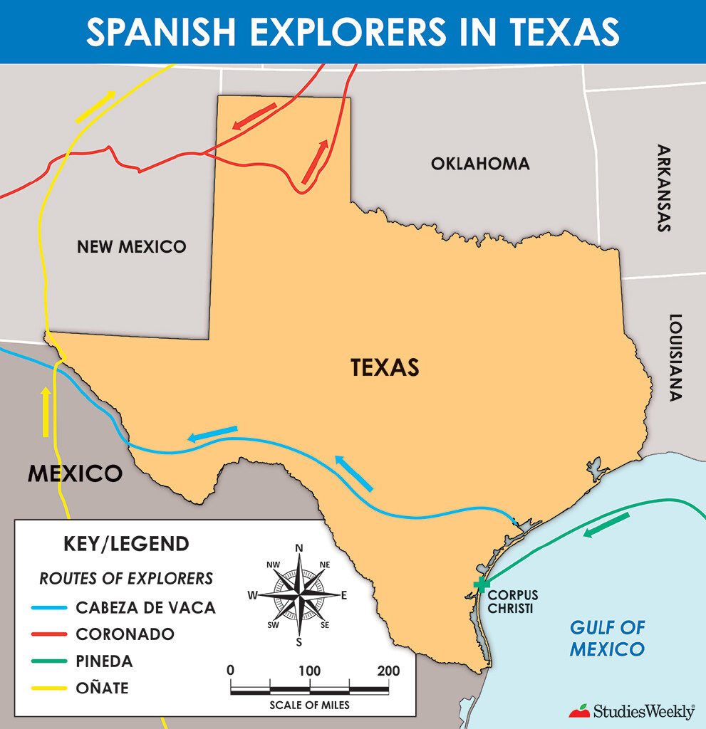
How many miles did Cabeza de Vaca travel across Texas?
500
250
50
750
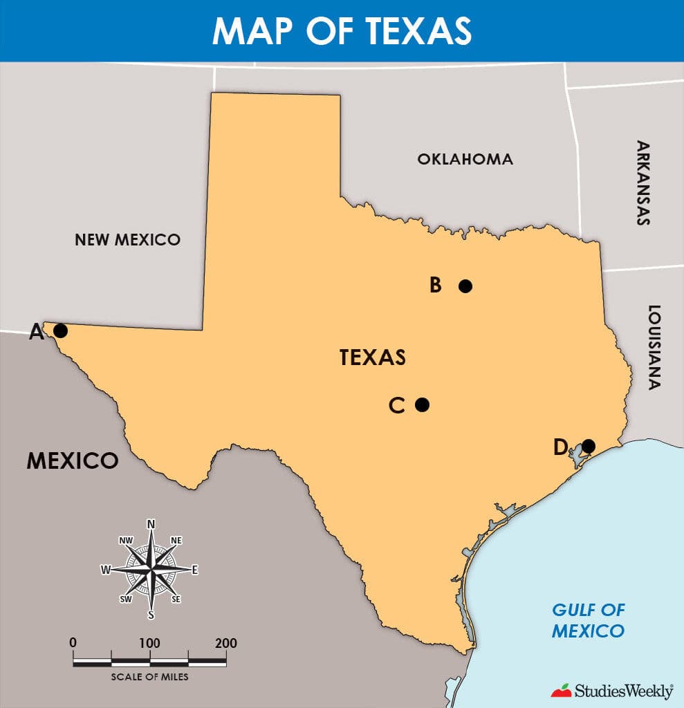
Which city is southeast of El Paso?

Amarillo
Fort Worth
Brownsville
Dallas
How many miles did Cabeza de Vaca travel across Texas?
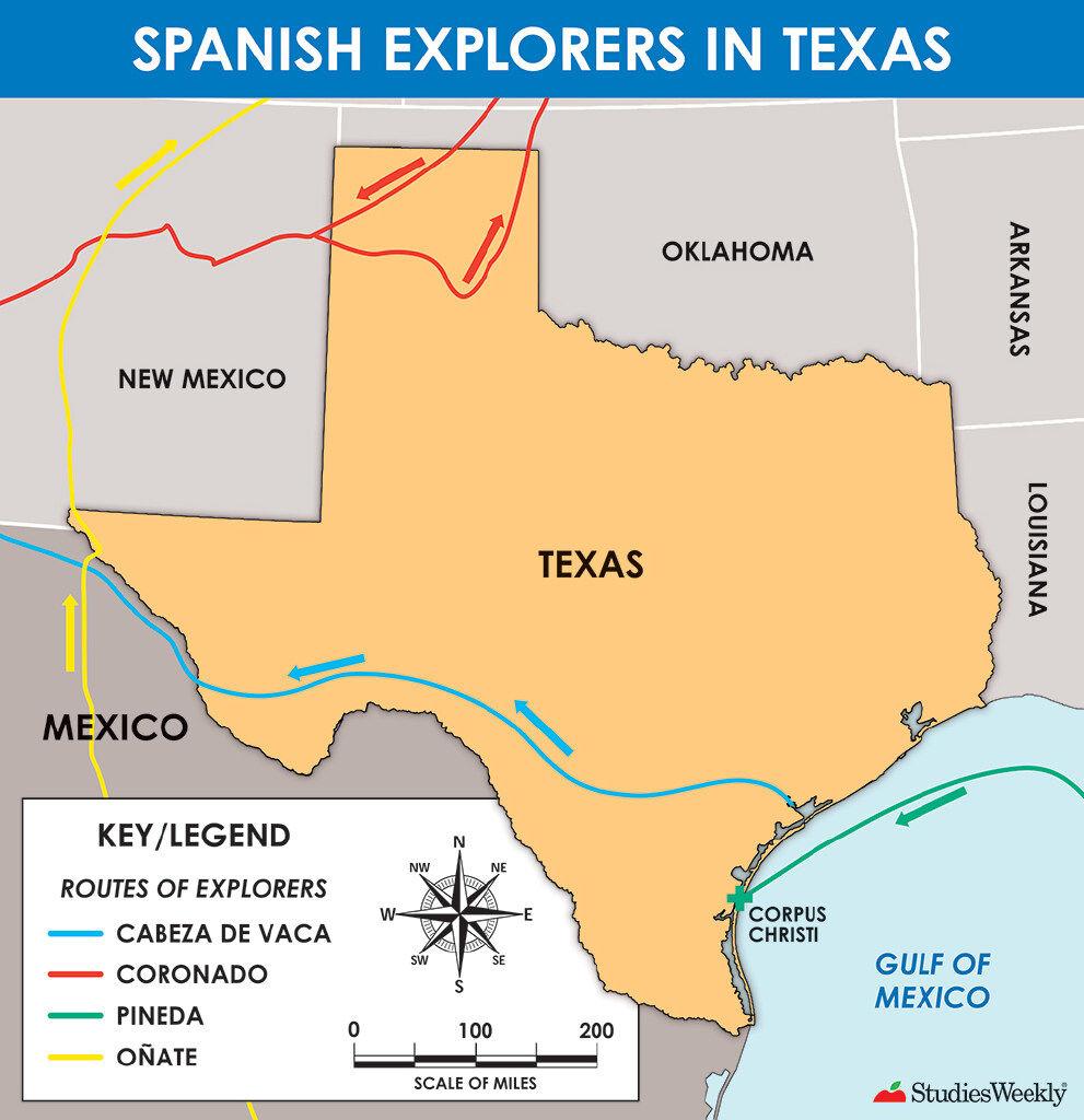
Which city is southeast of El Paso?
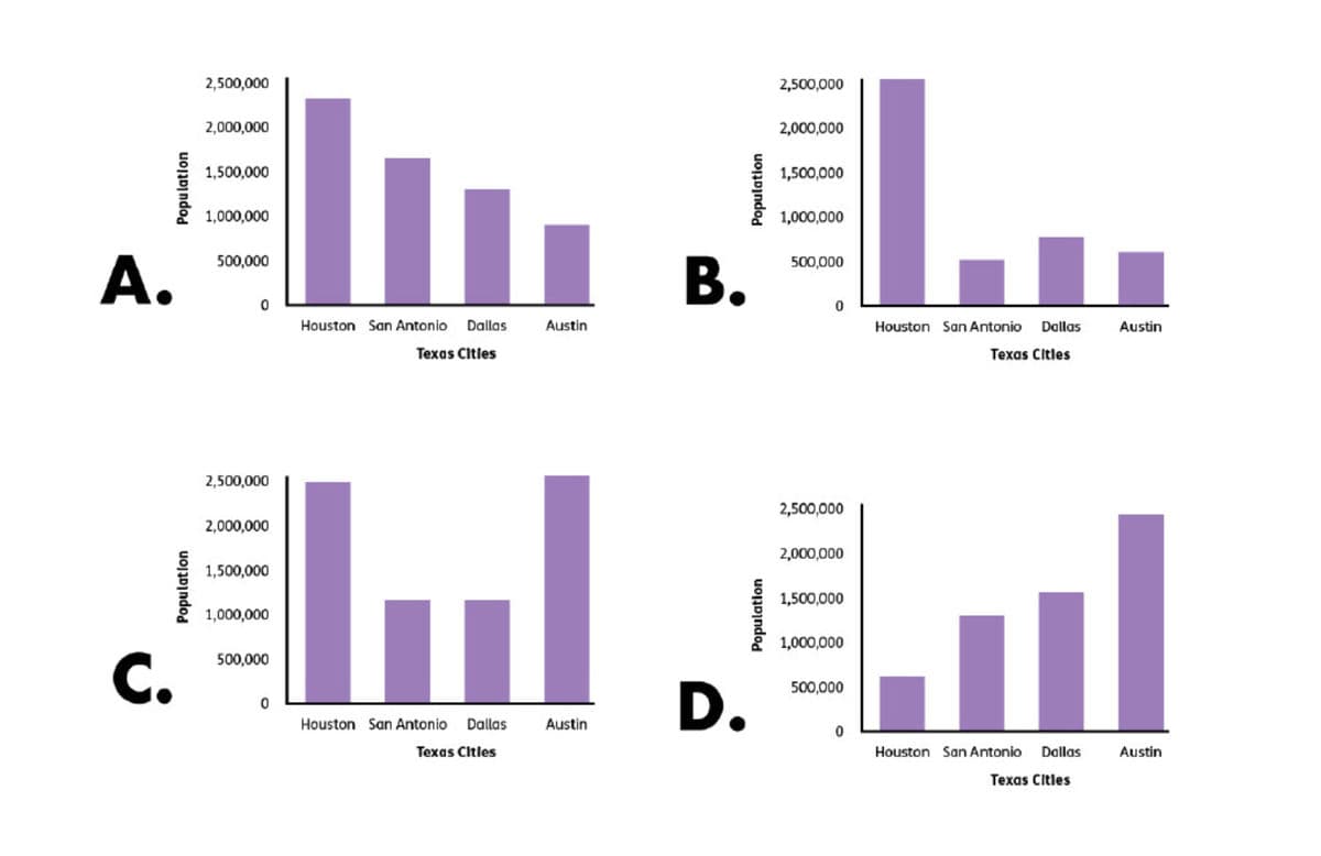
The populations of four Texas cities in the year 2019 were as follows:
Houston: 2,320,268
San Antonio: 1,547,253
Dallas: 1,343,573
Austin: 978,908
Which graph correctly represents the data?
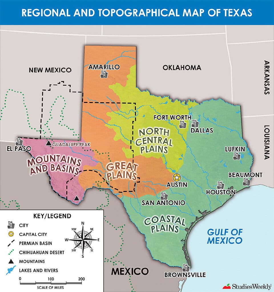
Use the list and the map to answer the question.
Oil was discovered.
Many jobs were available in the new oil industry.
The demand for oil increased.
Which area of the map is described by the list?
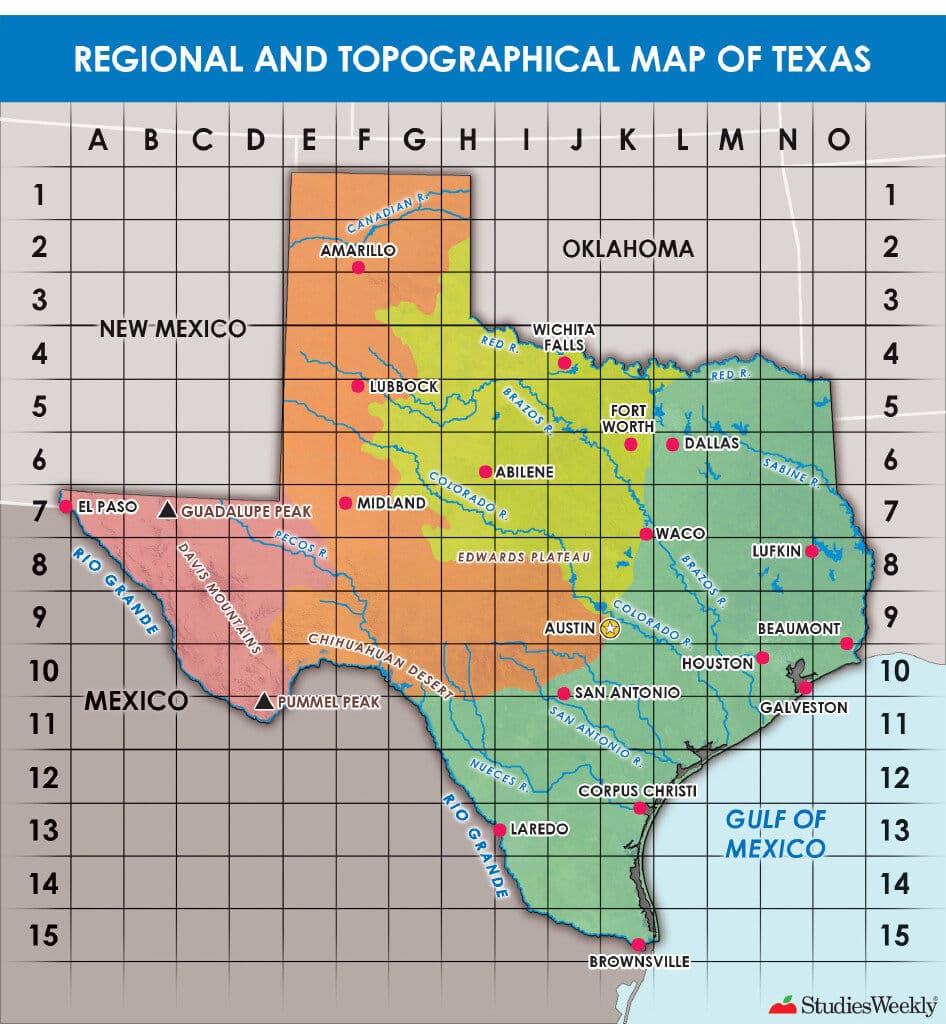
Which landform is located at B, 7?
Read the passage:
There are different ways we can study the world's geography. A globe is a round model of the Earth. Globes show us where water, land, and countries are located. Globes are useful when you need to see the Earth in a more accurate, spherical shape.
“Models of the World”
What conclusion can be made about maps from the passage?
Read the passage:
Maps are geographic representations of places. We use these representations to acquire, process, and report information from a spatial perspective. One of the questions geographers ask is where something is located. Location allows us to describe where a place is.
“Location”
How do maps help people describe location?
Is the following an example of relative location or absolute location?
1234 Main Street
Is the following an example of absolute location or relative location?
north of Pummel Peak
Which of the following is the definition of cartographer?