

Types of Maps Check In
Quiz by Katheryn Lofstedt
Feel free to use or edit a copy
includes Teacher and Student dashboards
Measure skillsfrom any curriculum
Tag the questions with any skills you have. Your dashboard will track each student's mastery of each skill.
- edit the questions
- save a copy for later
- start a class game
- automatically assign follow-up activities based on students’ scores
- assign as homework
- share a link with colleagues
- print as a bubble sheet
- Q 1/8Score 0
What type of map is this?
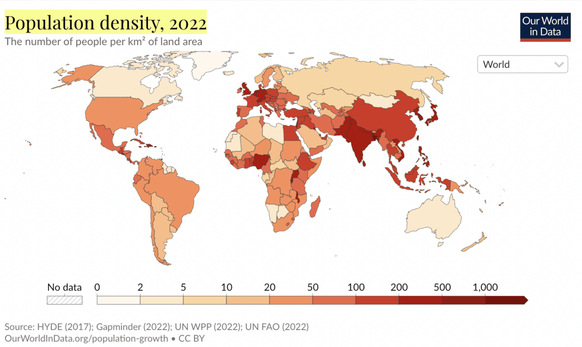
29Population Density
Political Map
Vegetation Zones
Climate Zones
Physical Features


- Q1
What type of map is this?
Population Density
Political Map
Vegetation Zones
Climate Zones
Physical Features
30s - Q2
A map that show plants that grow in a specific area is called a...
Climate Zones
Political Map
Vegetation Zones
Physical Features
Population Density
30s - Q3
Mountains, rivers, lakes, and plains would be on a...
Population Density
Climate Zones
Vegetation Zones
Physical Features
Political Map
30s - Q4
A map that show the weather, temperature, and precipitation in an area is called a...
Political Map
Climate Zones
Vegetation Zones
Physical Features
Population Density
30s - Q5
A map that shows states, countries, and cities is called a...
Climate Zones
Population Density
Physical Features
Economic Activity
Vegetation Zones
Political Map
30s - Q6
A map that shows how people make a living is called a...
Climate Zones
Population Density
Economic Activity
Vegetation Zones
Physical Features
Political Map
30s - Q7
A map that shows landforms is called a...
Physical Features
Population Density
Climate Zones
Economic Activity
Political Map
Vegetation Zones
30s - Q8
What is a region?
Users enter free textType an Answer30s


