Loading...
Unit 3 Natural Hazards TEST REVIEW
Quiz by 8science PMS
Customize this quiz to suit your class
Instantly translate to 100+ languages
Tag the questions with any skills you have. Your dashboard will track each student's mastery of each skill.
Give this quiz to my class
What technologies currently exist in our area (MS/LA gulf coast) to mitigate the effect of hurricanes?
Build buildings out of renewable resources
Elevate buildings and cities; build flood walls
Build buildings in circles with surrounding walls
There is currently no technology
Rock underground suddenly breaks along a fault causing tectonic movement, causing what natural hazard?
Earthquake
Hurricane
Landslide
Volcanic Eruption
What technologies currently exist in our area (MS/LA gulf coast) to mitigate the effect of hurricanes?
Rock underground suddenly breaks along a fault causing tectonic movement, causing what natural hazard?
A seismograph can be used to measure and study what?
Flooding, property damage, fatalities, and fires are all effects of what natural hazard?
A tiltmeter measures the vertical distance changes in Earth's crust. Which hazard is this tool used to study?

Scientists can predict exactly when a volcanic eruption will occur.
Why is it beneficial to be able to predict when and where natural hazards will occur?
What is the best way to collect data from a hurricane?
Why do so many volcanoes and earthquakes happen along plate boundaries?
Match the following
A tsunami is:
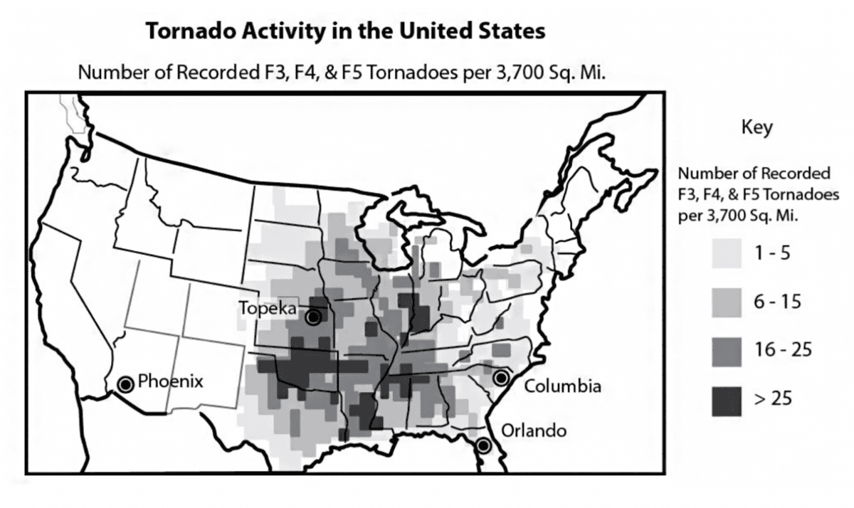
This map shows tornado activity in the United States between 1950 and 1998. Based on the data provided by this map, which of the following cities would be most likely to experience a tornado with a rating of F3 or greater in the next year?
Natural hazards become natural disasters when people's lives and livelihoods are destroyed.
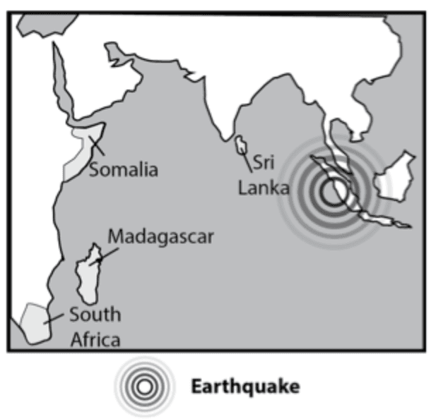
The provided map shows the location of an earthquake under the ocean.
The data on the map would best support a prediction of which of the following events?
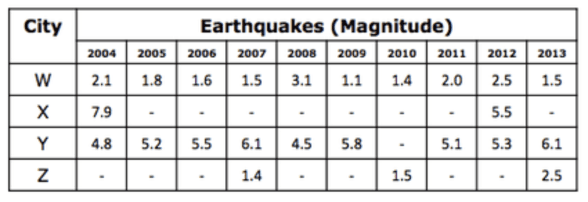
The table provides data on the earthquakes recorded for four different cities over a ten year period. Assuming the data indicates patterns that will continue, which city will most likely experience an earthquake of a magnitude of 5.0 or higher in the next year or two?
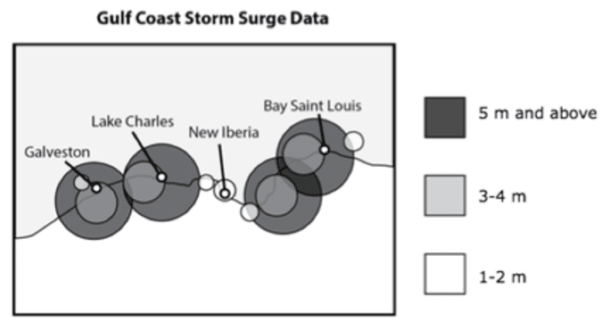
This map provides historical data on storm surges associated with hurricanes in the Gulf of Mexico. A storm surge is a rise of water that can be as high as 5 meters or more. To protect citizens from storm surges, cities sometimes build levees, walls that can hold back the water. Using the information provided, which city would most likely be able to protect its citizens with a levee that is only 3 meters in height?
A scientist used a model to predict the path of a hurricane. The hurricane followed a similar path but did not follow the exact path that was predicted. How does this example demonstrate a limitation of models?
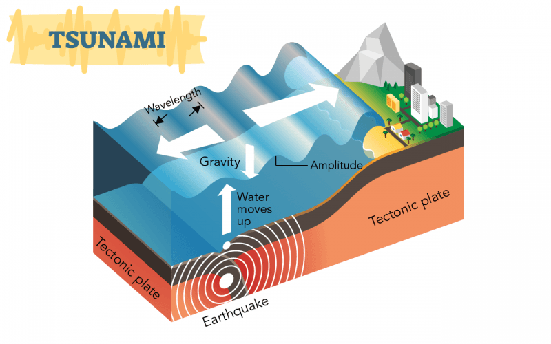
Chain of events that cause a tsunami
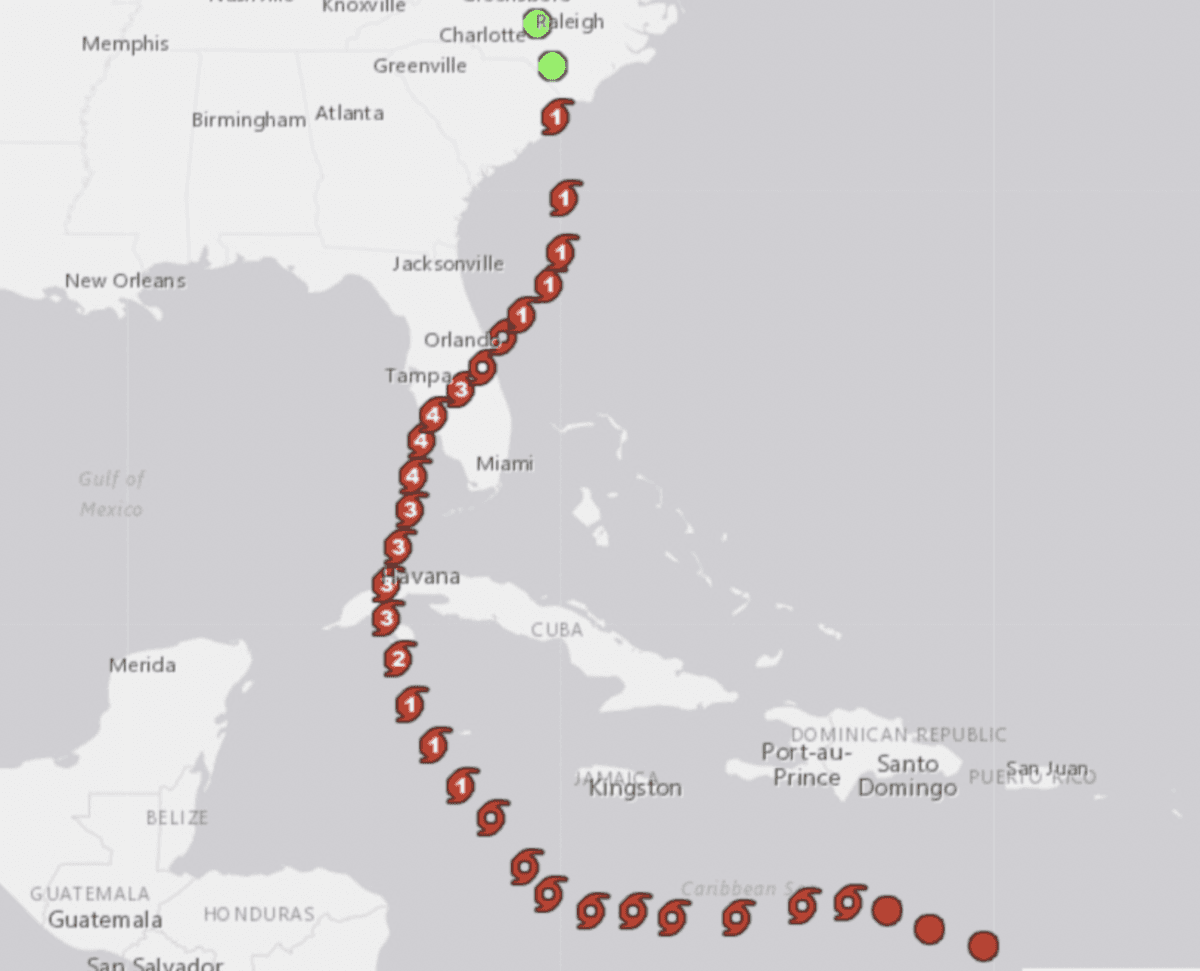
Where does hurricane Ian hit as a category 4 hurricane first?
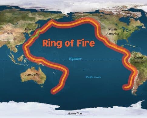
The ring of fire is where the pacific plate meets other tectonic plates at a tectonic plate boundary. What are the risks living on the shores of the Ring of Fire?
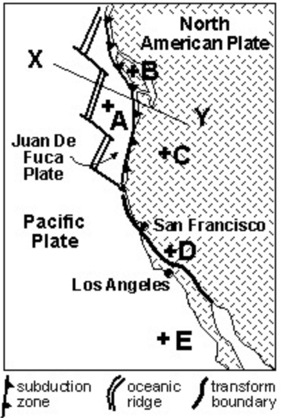
Which letter represents the most danger to a human population from an earthquake?
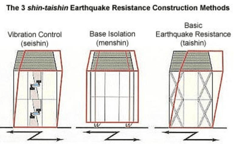
What is something we could put in place to help reduce the loss of lives in the event of an earthquake?
A town is deciding where to build a new road. There have been landslides in this town in the past. Which information will help the engineers decide where to put the road to avoid damage due to landslides?
Which places will experience frequent earthquakes?
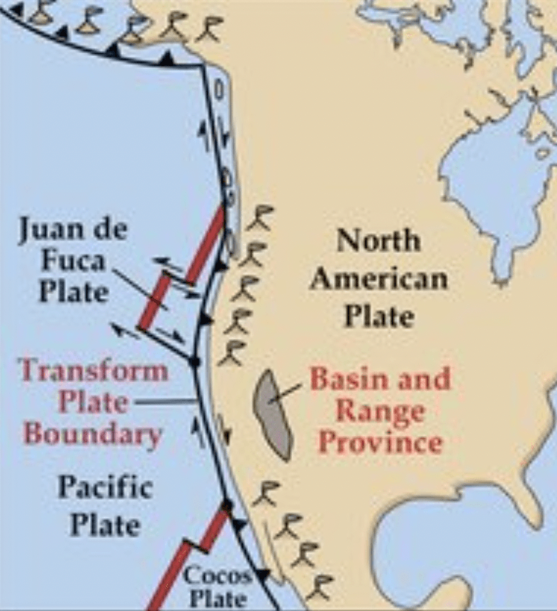
Why do volcanoes form in the states Oregon and Washington?