

Unit 3-North America Physical Mapping
Quiz by Alecia Dockery
Feel free to use or edit a copy
includes Teacher and Student dashboards
Measure skillsfrom any curriculum
Measure skills
from any curriculum
Tag the questions with any skills you have. Your dashboard will track each student's mastery of each skill.
With a free account, teachers can
- edit the questions
- save a copy for later
- start a class game
- automatically assign follow-up activities based on students’ scores
- assign as homework
- share a link with colleagues
- print as a bubble sheet
- Q 1/27Score 0The area between the Rocky Mountains and the Sierra Nevadas. Dry desert, mostly.29Great Basin


27 questions
Show answers
- Q1The area between the Rocky Mountains and the Sierra Nevadas. Dry desert, mostly.Great Basin30s
- Q2a vast prairie region extending from Alberta and Saskatchewan and Manitoba in Canada south through the west central United States into TexasGreat Plains30s
- Q3Southern AlaskaAlaska Range30s
- Q4a mountain range located in northern Alaska and YukonBrooks Range30s
- Q5A major mountain system of the United states and Canada, extending 3,000 miles from Alaska south to New MexicoRocky Mountains30s
- Q6A mountain range that stretches from eastern Canada south to Alabama.Appalachian Mountains30s
- Q7A major North American river and the chief river of the United States, longest river in the U.S.Mississippi River30s
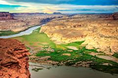
- Q8River in south west US which starts in the Rocky mountains and ends in the gulfColorado River30s
- Q9Large river that forms a border between the US and MexicoRio Grande River30s
- Q10Longest river in North AmericaMissouri River30s
- Q11a body of water that is located off the southern coast of AlaskaGulf of Alaska30s
- Q12A large gulf off the southeastern coast of North AmericaGulf of Mexico30s
- Q13largest oceanPacific Ocean30s
- Q14What ocean lies to the east of the U.S. and the West Africa and EuropeAtlantic Ocean30s
- Q15Second among the largest lakes in the USLake Huron30s


