
Atlantic World Review
Quiz by Karin Westhead
Customize this quiz to suit your class
Instantly translate to 100+ languages
Tag the questions with any skills you have. Your dashboard will track each student's mastery of each skill.
Give this quiz to my class
​Isaac Newton discovered gravity?
​______ is a time period of rebirth or revived ideas of Greece & Rome.
Renaissance
Scientific Revolution
Reformation
Exploration
Isaac Newton discovered gravity?
______ is a time period of rebirth or revived ideas of Greece & Rome.
Supports the Counter Reformation
Led the way in exploration (country)
Heliocentric theory supports....
Africans were the 1st to be enslaved in the New World?
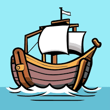
Lateen sail, magnetic compass, caravel & astrolable (examples)
Mona Lisa & Last Supper
Geocentric theory supports....
Triangle Trade = Trans Atlantic Slave Trade
Improved Literacy in the Renaissance
Michelangelo artwork(s):
Who improved the telescope & proved Copernicus' theory
Diet of Worms is the location of ___ trial
Country who wanted permanent settlements in New World?
The impact of the French Revolution in the Atlantic world
2nde DNL. The Atlantic Opening. The world at a glance
Sarah is a 19-year-old woman who sailed solo around the world in just one year. Listen to the following excerpts from her taped journal as she sailed. January 10th: I left the island of Jamaica yesterday, and now I’m on my way to the Panama Canal. I’m excited, because I never tried to sail around the world alone before. February 23rd: I arrived at the Galapagos Islands today. It’s my first time here. There are so many amazing animals to see on these islands – sea lions, iguanas, and the Galapagos tortoise. August 15th: I am now in Darwin, Australia – at the northern point of this country. Sailing here was quite good, but sometimes the ocean was very rough. November 7th: I’m now in South Africa, in Port Elizabeth. Many people welcomed me when I came into port. I’m happy, but I still have to cross the Atlantic Ocean. December 30th: I can see the city of Kingston in the distance. There are many boats around me, and people are congratulating me. I did it! I met my goal! I sailed around the world in less than a year.
France Where Is It? France is a country in Europe. Other countries are to the east. To the south is Spain. The Atlantic Ocean is to the north and to the west. The United Kingdom is to the north. It is across a part of the Atlantic Ocean called the English Channel. Paris is the capital city of France. It is a very famous city. Millions of tourists visit Paris every year. More than ten million people live there. People. More than sixty-six million people live in France. Most people live and work in cities. Some have jobs helping tourists who visit France. Some people live in the countryside and grow food on farms. More than half of the land in France is used for farming. Most people in France speak French. Land. France has many different kinds of land. It has hills, forests, rivers, lakes, and beaches. Most of France is covered with low plains and hills. France also has five mountain ranges. They sit between France and other countries. The highest mountains are in the Alps. History. Long ago, France was called Gaul. Other countries took over Gaul many times. The Romans took it over first, and then the Franks took it from the Romans. France got its name from the Franks. For a long time, France was ruled by powerful kings. Then the French people fought against one king. This was called the French Revolution (1789–1799). Today, France is a democracy. Celebrations People in France celebrate the beginning of the revolution on July 14. They celebrate with fireworks and parades. Food. France is known for its food. One type of food is a long, thin loaf of bread. Many meals have more than one part. A meal may have soup, salad, a main course, and fruit for dessert. Conclusion France is a beautiful country with a long history. It has rolling hills, forests, and mountains. Its food is known around the world. What do you like most about France?
Need for resources Find gold More land Find faster route to India & China Spread Christianity Sailors & warriors from Scandinavia 1st Europeans in North America Reached Newfoundland, Canada, 932 C.E. Found grapes, timber, furs Quit coming around 1010 Italian sent by Spain Tried to reach Asia Landed in the Caribbean islands in 1492 Made 4 total voyages Claimed land for Spain Italian sent by England Looked for route to Asia Explored the coast of New Foundland, Canada in 1497 Claimed land for England Made 3 voyages across the Atlantic Italian navigator on Spanish ship Wrote a popular book about travels North & South America were named for him Spanish explorer Crossed the Isthmus of Panama to the Pacific Ocean in 1513 1st European to reach the Pacific through the New World French explorer Sailed up St. Lawrence River looking for a NW Passage Named & claimed Canada for France Made 3 voyages to explore Canada Spanish explorer & governor of Puerto Rico Searched for a mythical “Fountain of Youth” Claimed Florida for Spain in 1513 Spanish conquistador Conquered the Aztecs in 1519-1521 Claimed Mexico for Spain Spanish explorer & conquistador Searched for the mythical “7 Cities of Gold” 1st European to see the Grand Canyon & American southwest Claimed land north of Mexico for Spain Englishman who sailed for the English and Dutch, 1609-1611 Claimed Hudson River and modern NY for Dutch Claimed Hudson Bay area for England French explorer Explored & established forts from the Great Lakes down the Mississippi River Claimed Louisiana for France
Brazil Where Is It? Brazil is the biggest country in South America. It covers almost half of the continent. Other countries border it to the north, south, and west. The Atlantic Ocean is to the east. The capital city of Brazil is BrasĂlia. BrasĂlia became the capital in 1960. The city was built to be the capital. It was built in only a few years. People. More than 200 million people live in Brazil. Most people in Brazil speak Portuguese. Most people in Brazil live in cities. Many of these cities are on the coast. Some people live in the country. Land. Brazil has many different kinds of land. It has beaches and tall mountains. It also has flat land covered with water. Brazil is home to the Amazon rainforest. It covers almost half of Brazil. It is the biggest rainforest in the world. The Amazon River runs through the rainforest. It is one of the longest rivers in the world. Celebrations. People in Brazil celebrate Carnaval. The holiday happens during Brazil's summer. It goes on for four days. People dress up and walk in big parades. People play many different kinds of music. The party is one of the biggest in the world. Animals. Many animals live in the Amazon rainforest. Parrots live there. They have colorful feathers. Colorful frogs live there, too. They live on the ground and in the trees. Many ants live in the rainforest. Fire ants and leaf-cutter ants live there. Many spiders live in the rainforest, too. The biggest spider in the world lives there. Conclusion. Brazil is an exciting country. It has big cities. It has forests filled with many animals. What do you like most about Brazil? Brazil. Population: 202,656,788. Land: 8,458,417 sq km (3,265,813 sq. mi.) Capital City: BrasĂlia. Primary Language: Portuguese. Currency: Real.
Continental Drift Theory. From the discussion of the rock cycle, it has been pointed out that through Earth's external and internal processes. Earth's surface is constantly changing. However, this idea of a changing environment did not conform with the belief of earlier scientists. Rather, they thought that the geographic positions of ocean basins and continents have been static since the beginning of time. It was around the 1500s when Leonardo da Vinci, upon his discovery of fossil seashells found at the high mountains of Italy, first thought of the idea that the areas where mountains are located may have been oceans in the past. Through time, other fossils of marine organisms found far above the current sea level further supported the idea that mountains were uplifted and weathering wore them down. At around the 1800s, most scientists have accepted the idea that Earth's crust is undergoing large vertical movements or uplifting. There was also evidence of possible horizontal movements, but the scientists then were not convinced about it. Alfred Wegener showed evidence of horizontal or lateral movement of the continents in his continental drift theory. According to him, the continents have drifted around the world and have once formed a giant landmass or supercontinent called Pangaea. To support his theory, Alfred Wegener presented a set of geographical, biological, and climatic evidence.Wegener's geographical evidence included the jigsaw puzzle fit of the current continents. He pointed out that the coastlines of South America and Africa seem to fit together. He also pointed the presence of mountain ranges having similar rock types and age but separated by vast oceans, like that of the folded rocks of the Caledonian mountains. The same folded rocks run through West Africa, North America, Newfoundland, Ireland, Wales, Scotland, Greenland, and Norway, all of which are now separated by the Atlantic Ocean. A geographical evidence on the similar rock types in West Africa, North America, Greenland, and Europe is found. The biological evidence came in the discovery of similar plant and animal fossils in different continents separated by oceans. The animal fossils of Mesosaurus and Lystrosaurus indicate that they were not capable of crossing the oceans to reach the other continents. If they were, the fossils should have been more widely distributed Africa, Australia, India, and South America were too large to be carried by wind. This indicates that the areas where the fossils were found were closely linked. It has also been found out that the plant only grew in areas with subpolar climate, which would indicate that the landmasses were located near the South Pole.Lastly, for his climatic evidence, Wegener discovered that a glacial period occurred during the late Paleozoic era in Southern Africa, South America, Australia, and India. The initial explanation for this event was global cooling, but it was rejected because large tropical swamps with so much vegetation were found at the same time in the Northern Hemisphere. This further supported the idea that the supercontinent was indeed near the South Pole, and the continents in Northern Hemisphere were once near the equator. The glacial period also left glacial striations, or the scratches glaciers make as they move across on the underlying bedrock, on the aforementioned continents. For such an event to happen, the continents would have to be connected. SCIENCE PIONEER. Alfred Wegener (1880-1930). Alfred Wegener was a German polar researcher, geophysicist, and meteorologist. He was known for his work on the continental drift theory. In his effort to defend his work, he went to the Greenland ice sheet where he died.Even with all the compelling evidence, the continental drift theory hardly convinced the scientific community at that time because Wegener was unable to identify a credible mechanism that drives the continental drift. He was unable to clearly explain how the continents moved and how the larger continents broke through the ocean floor. Eventually, critics of the continental drift began to accept the theory when new evidence supporting the theory was discovered. The new evidence led to a more encompassing theory the theory of plate tectonics. This theory provided a more convincing explanation as to how the continents moved. The evidence that paved the way for the theory of plate tectonics was the idea of wandering poles. Scientists began studying volcanic rocks to determine the location of the magnetic poles. When volcanic rocks crystallize, the minerals with magnetic properties align themselves parallel to Earth's magnetic field at the time the minerals were formed. This finding allowed scientists to determine the polarity of Earth's magnetic field and the magnetic inclination that showed the location of the poles. Upon studying the paleomagnetism of the rocks, geophysicists found out that rocks from various locations point to different magnetic north poles, suggesting that the poles have wandered. Since movement of magnetic poles is very unlikely, scientists have accepted the idea that the continents are indeed moving. And if the continents are moving, scientists thought that maybe the ocean basins are moving too. They also discovered that some rocks showed magnetic reversals, which led them to believe that the magnetic north pole now was not always the magnetic north pole. Seafloor Spreading. After World War II, exploration on the ocean floor became the focus of many geologic studies. It was only then that the ocean ridge system was discovered. A geologist in Princeton University named Harry Hess, along with other scientists, studied this ocean ridge system and hypothesized that the oceanic crust was moving away from the ridge. His hypothesis, known as seafloor spreading, showed that the ocean floor is split along the ridge where the magma rises to form the new ocean floor.Because of this, rocks located near the ridge are younger than those that are located magnetic polarity of Earth is also preserved in those rocks. Withe ridge scientists were able to see the magnetic reversals in the ocean floor, and they were able to make use of information to determine that the ocean floor is moving at a rate of about 10 cm per year. Plate Tectonics. Confirmation of the seafloor spreading hypothesis proved that continents are not moving above the ocean floor. Rather, it is the fragments of the lithosphere. The lithosphere is the rigid layer that is composed of the uppermost mantle and the crust that carry the continents and the ocean basins along. These fragments of the lithosphere are called plates. Underneath the lithosphere is a weaker region in the mantle known as asthenosphere that behaves like a fluid. Thus, the lithosphere floats above the asthenosphere, making it detached and free to move. This became the basis of the theory of plate tectonics. Now that it has been made clear that it is the plates which are moving, the question as to how they move remained. Sir Arthur Holmes proposed the driving force for this plate movement in 1919. He suggested that the movement in the mantle carries the plates along. It was previously discussed that Earth's interior is very hot due to the heat produced by radioactive decay. Convection takes place in the mantle, keeping the asthenosphere hot and weak. The convection currents produced in the asthenosphere are the ones carrying the lithospheric plates and making them move. However, convection currents are not enough. Mechanisms such as ridge push and slab pull aid the convection currents to slowly move the lithospheric plates. Ridge push occurs at mid ocean ridges which are higher in elevation than the surrounding trenches and abyssal plains. The new ocean floor from the ridge is hot and relatively thin. As it moves away from the ridge, it cools down and gets denser, heavier, and thicker. Below this cooling ocean floor is the asthenosphere, which is less dense. This area becomes a massive shear zone and the new ocean floor will effectively slide down the slope of the asthenosphere. When the plate collides with another plate with lesser density, the denser plate sinks and a subduction zone is formed. When the subducting plate sinks, it pulls on the rest of the plate behind it. These mechanisms explain the movement of the plates.Earth has seven major lithospheric plates that account for 94% of Earth's surface. These are the North American Plate, South American Plate, Pacific Plate, African Plate, Eurasian Plate, Indo-Australian Plate, and Antarctic Plate. These plates are constantly moving relative to the other plates. Thus, the interaction of plates occurs mostly along the boundaries. These movements are plotted using information from earthquakes and volcanic activities. There are three main types of plate boundaries: convergent, divergent, and transform boundaries Convergent boundaries are boundaries where two plates move towards each other A convergent boundary is also known as destructive margin since this is where the collision between two plates occhins. There are three types of convergence-oceanic oceanic, oceanic-continental, and continental-continental. Trenches are features of the ocean floor that are present in both oceanic-oceanic boundary and oceanic-continental boundary. Subduction occurs at the trenches, therefore, these are characterized as the deepest parts of Earth. A divergent boundary is the opposite of convergent boundary: two plates move away from each other. Divergent boundaries create new crust; thus, they are also known as constructive margins. The ocean ridge system is a divergent boundary where new ocean floor is produced as magma rises, pushing the older rocks aside.Transform boundary is also known as conservative plate margin since two plates just move past one another, neither creating nor destroying land. Earthquake epicenters are usually detected at transform boundaries because the rocks tend to break and not fold or sink, like in convergent boundaries. Evolution of the Ocean Basins. Both the movement of the plates and seafloor are responsible for the evolution of ocean basins. Along the divergent boundary where ocean ridge systems are found, magma is released and new ocean floor is created. Along convergent boundaries, the ocean floor is being destroyed. The evolution of the ocean basins started during the time when Pangaea was still present and was surrounded by the vast ocean or superocean known as Panthalassa, also called Paleo-Pacific or "old Pacific." Upon the initial break up of Pangaea into Laurasia and Gondwanaland, the Tethys Sea began to form. Then, the Eurasian and North about, forming the North Atlantic. The South Atlantic only started to form when the African Plate and South American Plate separated. The continued movement of the plates created the Himalayas at one side and separated the Pacific Ocean and Atlantic Ocean at the other side, which consequently formed the current ocean basins. Both the movement of the plates and seafloor are responsible for the evolution of ocean basins. Along the divergent boundary where ocean ridge systems are found, magma is released and new ocean floor is created. Along convergent boundaries, the ocean floor is being destroyed. The evolution of the ocean basins started during the time when Pangaea was still present and was surrounded by the vast ocean or superocean known as Panthalassa, also called Paleo-Pacific or "old Pacific." Upon the initial break up of Pangaea into Laurasia and Gondwanaland, the Tethys Sea began to form. Then, the Eurasian and North about, forming the North Atlantic. The South Atlantic only started to form when the African Plate and South American Plate separated. The continued movement of the plates created the Himalayas at one side and separated the Pacific Ocean and Atlantic Ocean at the other side, which consequently formed the current ocean basins.Continents do not immediately end at the point where the ocean meets the land. They may extend slightly into the oceans. The portion of the continent that is submerged is called continental margin. There are two types of continental margin: passive margin and active margin. A passive continental margin consists of a continental shelf, continental slope, and continental rise. It is not associated with plate boundaries; thus, there are very little tectonic activities. An active continental margin only has a continental shelf and a continental slope. It is associated with plate boundaries; thus, a main feature of this boundary is a trench. The different features of a continental margin are the following: 1. The continental shelf is the gently-sloping submerged portion of the continent. 2. The continental slope is the steep slope after the continental shelf. It is still part of the continent. 3. The continental rise is the gently-sloping area after the continental slope and before the ocean floor. 4. The trenches are the deepest parts of the ocean. These are narrow depressions caused by the subduction of the ocean floor along the convergent boundaries. 5. The mid-oceanic ridge is the mountain range system in the ocean. It is responsible for the production of new ocean floor. This is the region where new magma constantly emerges from. SCIENCE CAREER. A scientific illustrator uses art to inform and communicate complex details and concepts of science. He/She makes use of scientifically informed observations and research along with his/her technical art and aesthetic skills to make accurate representations. In Natural History, the scientific illustrators recreate how the extinct species look like by working with scientists and fossil records. Moreover, with the advances in technology, illustrators are now into 3D modelling, animation, and video making. Earth's History. All the processes that have been discussed require long periods of time to create a noticeable change on Earth's surface. You can just imagine how long it would take to create an oceanas vast as the Pacific Ocean if the ocean floor moves only at about 10 cm/year. It is then important to know the history of Earth to learn the complexities of its past and be able to use it to understand the present. Just like learning the history of a country that requires one to read a lot of books, learning the history of Earth involves studying a lot of rocks. Rocks, especially sedimentary rocks, contain a lot of information about Earth's past. It holds the key to most of the geologic processes that happened on Earth and the key to uncovering how life on Earth evolved. But these discoveries are worthless if there is no time perspective. Thus, one of the most important contributions of geologists to mankind is the geologic time scale, which holds a history that is exceedingly long.
Chapter 8: The Worlds of North and South Geography Geography refers to the seasons, climate, soil, and physical features of a region (mountains, rivers, etc.) The differences in geography b/t the N and S is one of the major reasons slavery b/c entrenched in the S while it died out in the N. Geography of the North The N has diverse geography and experiences four distinct seasons including long, harsh winters. The Great Plains region has some of the best farmland in the country. New England has rocky, hilly wilderness, not well suited for farming. It has hundreds of bays and harbors along its coastline. States farther S had rich soil and coastal access through rivers. The N also experienced mass deforestation b/c of the need for lumber and to make room for farms. Geography of the South Climate: the S had mild winters, and a long, hot, humid growing season. It has fertile lowlands, marshes and swamps. It's ideal for growing tobacco, sugar, rice, indigo, and cotton (cash crops). B/c of the geography of the S, their whole way of life was based on agriculture and geography is one of the major reasons why slavery took off in the S. Economies Economy basically refers to the way people make and spend money. The Northern economy was far more diversified than the Southern. Economy of the North The North experienced the Industrial Revolution—the shift from handmade goods to machine-made goods. This resulted in new jobs, increased production, and improved efficiency in agriculture. IOW, you can make things faster, easier, and cheaper. More ppl get more stuff. Factories were almost always located next to rivers. The Reaper The Indust. Rev. changed northern agriculture with Cyrus McCormick’s reaper. It could cut 28xs more grain than a single man. The Sewing Machine Elias Howe's sewing machine; At 250 stitches a minute, Howe's lockstitch mechanism out-stitched the output of five hand seamstresses with a reputation for speed, completing in one hour what took the sewers 14.5 hours. The Textile Mill Francis Cabot Lowell's textile mill: essentially the first factory in the US, Lowell set the model for all future factories. Interchangeable Parts Eli Whitney's interchangeable parts; considered the "dawning of a new age" of machinery. This concept was applied to pretty much all manufacturing. Economy of the South The South's economy was based on AGRICULTURE. Most southerners were agrarians. Most had small farms, some owned plantations. Slavery beginning to decline in late 1700s; prices went down (tobacco, indigo) and cotton was difficult. King Cotton Cotton was South’s most important crop. Earned more money than all other exports combined. The S would go on to supply 75% of the world's cotton demand. Cotton Gin Eli Whitney invented the cotton gin in 1794 and forever changed the US. The gin made cotton incredibly profitable. We start to see the effects of the cotton gin around 1820. Slavery and Cotton Southerners put all their money into slaves and land, and almost none into building factories. With the spread of cotton, demand for slaves increased. 1790 to 1850, number of slaves rose 600%. Transportation Again, the N was far more inventive in their approach to transportation than the S. Transportation in the North National Road National Road stretched from the East (the Potomac), over the Appalachians, to the West (Illinois), over 620 miles. Steamboat In 1807, Robert Fulton invented the steamboat. It traveled 150 miles UP the Hudson River at a speed of 5 mph. Erie Canal Built b/t 1817 and 1825, the canal spanned 363 miles and connected Lake Erie to the Hudson River. This connected farms in the W to cities in the E and the Atlantic Ocean. Clipper Ship Clippers were narrow w massive sails that were built for speed. They cut the time it took to cross the Atlantic in half. Locomotive The fastest and cheapest way to move goods was by steam-powered trains. The first RR was the B&O which was built in 1827. Transportation in the South Most people and goods in the South traveled by rivers in steamboats. The South had trains, but less than half the amount of railroad track than the North had. Society (The People) The people who made up the N and S could not have been more different. The S was primarily agrarian while the N was b/c urbanized. The S was holding on to the past, while the N was embracing change. Society in the South Society was organized into 3 distinct classes of people: rich plantation owners at the top; then white farmers and workers; slaves on the bottom. This rigid social class system was the result of a slave-based agricultural system. Power Structure Only 1 in 4 whites owned a slave. Plantation owners, who owned more than 20 slaves, dominated politics and the economy. Society in the North 7 of 10 Northerners still lived on farms by the 1840s (6 of 10 by 1860), but urbanization was growing fast in the N. The N relied on wage labor as opposed to slave labor, so most blacks in the N were free. N blacks were not treated equally and the N was about as racist as the S. Immigration Compared to the S, the N population was exploding, in large part bc of immigration. Between 1845 and 1860, 4 million immigrants came to the North. Most were German and Irish. Irish--a potato famine; German--a failed revolution. Ethnic neighborhoods developed as a result.