
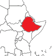
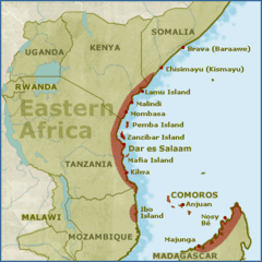
Eastern Africa Sec 1-2 Facts Map
Quiz by John Hagenmaier
Feel free to use or edit a copy
includes Teacher and Student dashboards
Measure skillsfrom any curriculum
Measure skills
from any curriculum
Tag the questions with any skills you have. Your dashboard will track each student's mastery of each skill.
With a free account, teachers can
- edit the questions
- save a copy for later
- start a class game
- automatically assign follow-up activities based on students’ scores
- assign as homework
- share a link with colleagues
- print as a bubble sheet
40 questions
Show answers
- Q1map of the _____ Empire at its peakFrenchGermanBritishDutch30s
- Q2See imageRwandaMalawiBurundiUganda30s
- Q3Khartoum, Addis Ababa, Nairobi, Kampala, Kigali, & Mogadishu, are all capital ___ in East Africa are all ____ cities in East Africacapitalexport producingmajorempty30s
- Q4war in Sudan/South Sudan was between religions (Islam vs ___)ChristianJewHinduMuslim30s
- Q5a dry climate found on the Horn of Africa & the northern part of Sudantaigasteppedeserttropical rainforest30s
- Q6times when little rain falls & crops are killed, has led to famine in East African countriesebolamalnutritiondroughtmalaria30s
- Q7former Italian colony that broke away from Ethiopia in 1993, bordering the Red SeaDjiboutiEritreaSouth SudanBurundi30s
- Q8See imageEritreaSudanSomaliaEthiopia30s
- Q9only East African country NOT colonized by a European countryKenyaBurundiEthiopiaTanzania30s
- Q10See imageUgandaKenyaEthiopiaSouth Sudan30s
- Q11the feeling of one ethnic group that thinks its culture & way of life is superior to othersonomatopoeiahyperboleethnocentrismnationalism30s
- Q12countries from _____ divided up East Africa as coloniesAustraliaEuropeAmericaAsia30s
- Q13Ethiopia was the only East African country NOT colonized by a ___ countryAmericanAntarcticanAsianEuropean30s
- Q14map of the ____ Empire at its peakItalianDutchFrenchPolish30s
- Q15physical feature in East Africa, the ____ is formed as continental plates pull apartGreat Rift Valley30s