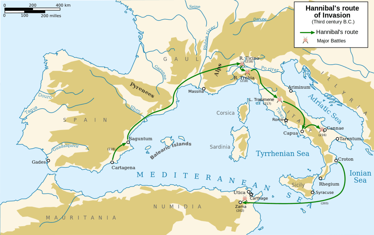
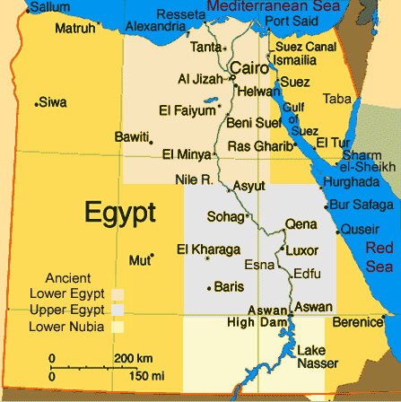
Our brand new solo games combine with your quiz, on the same screen

Correct quiz answers unlock more play!

New Quizalize solo game modes
10 questions
Show answers
  • Q1
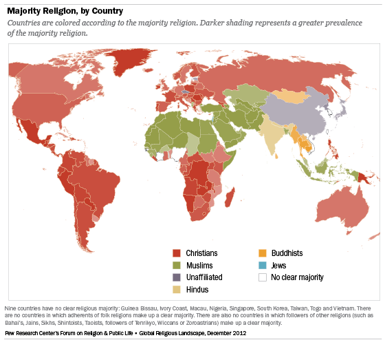
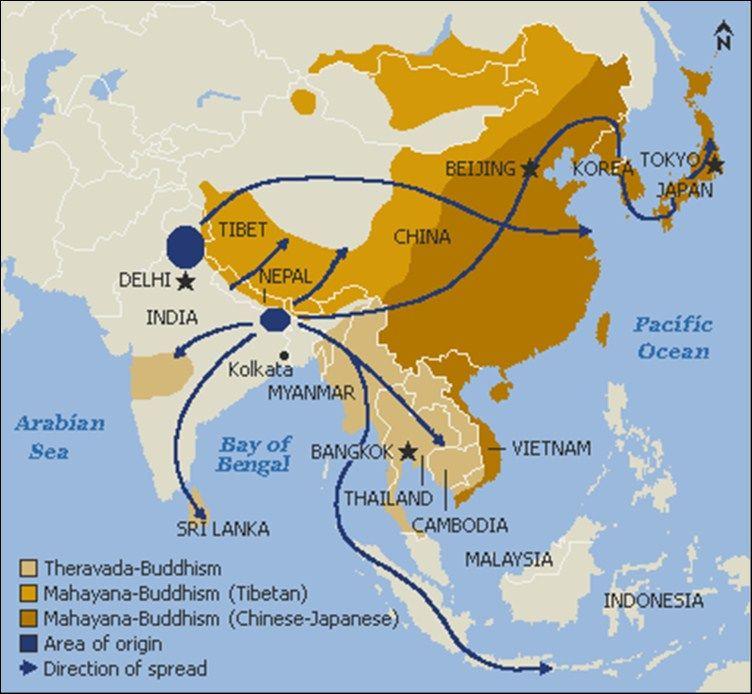
    The cartographer of this map most wanted to focus on:
    Question Image
    the political geography of Asia
    the spread of Buddhism
    the trade routes of Asia
    the physical geography of Asia
    60s
    6.3
  • Q2
    The title of this map is:
    Question Image
    Religions of the World
    Pew Research Center's Forum
    Prevalence of Christianity
    Majority Religion, by Country
    60s
    6.3
  • Q3
    The darker the color the:
    Question Image
    the less likely it is that the country allows other religions
    the less likely it is that people follow that faith
    the older the religion in that country
    more popular the religion in that country
    60s
    6.3
  • Q4
    The purpose of this map is to:
    Question Image
    show natural resources
    show climate zones
    show vegetation
    show weather
    60s
    6.3
  • Q5
    This map shows:
    Question Image
    climate
    population
    precipitation
    landforms
    60s
    6.3
  • Q6
    Why would a map like this be helpful?
    Question Image
    to guide agriculture
    to attract tourism
    to avoid the rainy seasons
    to find population centers
    60s
    6.3
  • Q7
    This is a population map of Africa. The darker colors mean:
    Question Image
    more large cities exist in the country
    fewer people live in a country
    more people live in a country
    fewer farmlands exist in a country
    60s
    6.3
  • Q8
    This map was created by cartographers to:
    Question Image
    show the progression of Hannibal in his military campaign
    demonstrate trade routes in Asia
    reflect the importance of water on transportation
    guide modern warfare and tactical strategies
    60s
    6.3
  • Q9
    This map is considered a:
    Question Image
    physical map
    political map
    special purpose map
    60s
    6.3
  • Q10
    The purpose of this map is to:
    Question Image
    provide a way to track flooding along the Nile
    show the arable land near the Nile and the desert surrounding it
    provide a way to locate the cataracts on the Nile
    show the regions/divisions of Ancient Cultures along the Nile
    60s
    6.3

Teachers give this quiz to your class