Develop and use models for the different types of plate tectonic settings (convergent, divergent and transform boundaries). (Clarification statement: Subduction zones, continental collisions, rift zones, and ocean basins should be included.)
Track each student's skills and progress in your Mastery dashboards
Give this quiz to my class
Q 1/10
Score 0
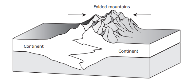
The model below shows two continental plates. The folded mountains in this model form at which type of plate boundary?
60
Divergent boundary
Transform boundary
Subduction boundary
Convergent boundary
Q 2/10
Score 0
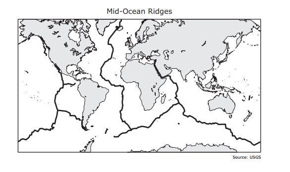
The thick black lines on the map below show the locations of mid-ocean ridges. Which geologic feature is most likely to form at a mid-ocean ridge?
60
Peninsula
Delta
Volcano
Plateau
10 questions
Q.
The model below shows two continental plates. The folded mountains in this model form at which type of plate boundary?
1
60 sec
SES2b
Q.
The thick black lines on the map below show the locations of mid-ocean ridges. Which geologic feature is most likely to form at a mid-ocean ridge?
2
60 sec
SES2b
Q.
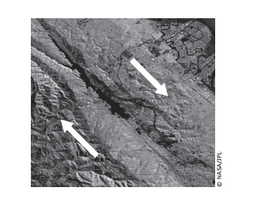
The image shows a plate boundary. Arrows have been added to indicate the movement of the plates. What plate boundary feature is also shown?
3
60 sec
SES2b
Q.
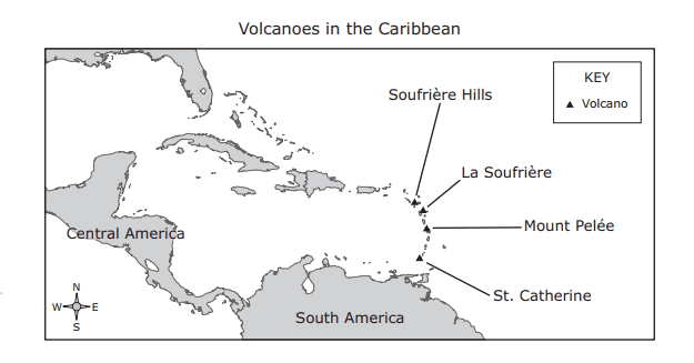
The map below shows the locations of four active volcanoes in the Caribbean Sea. What do these volcanoes indicate about plate tectonics in the region?
4
60 sec
SES2b
Q.
Rift valleys can form when fractures in Earth’s crust widen. The valley walls slowly move at a rate of only a few millimeters a year. Which of these best describes the type of tectonic activity that forms rift valleys?
5
60 sec
SES2b
Q.
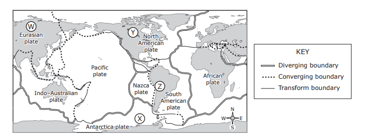
The map shows some of Earth’s plate tectonic boundaries. Based on the map, volcanic activity would most likely be found at —
6
60 sec
SES2b
Q.
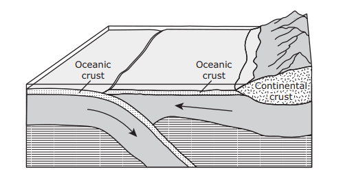
The diagram below shows a model of the movement of two tectonic plates. When the plates collide, one plate often moves below the other plate. The rising magma that can result from this type of plate movement may produce —
7
60 sec
SES2b
Q.
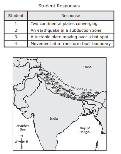
The Himalayan mountains are shown on the map below. Four students were asked to identify the geologic process that caused this mountain range to form. Their responses are shown below. Which student correctly identified the geologic process that formed the Himalayan mountains?
8
60 sec
SES2b
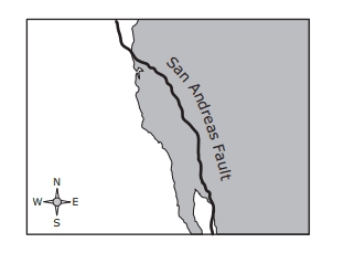
Q.
The San Andreas fault is a transform fault. The map below shows a student’s approximation of where the fault line crosses through the United States. Students were asked to make maps predicting which way land would most likely move over thousands of years. Which map best predicts the likely movement of land along the fault line over thousands of years?
9
60 sec
SES2b
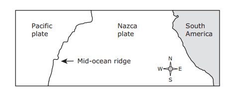
Q.
A mid-ocean ridge separates the Pacific plate and the Nazca plate off the western coast of South America. Which statement best describes the relative motions of the Pacific and Nazca plates?