Loading...
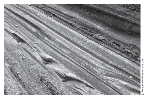
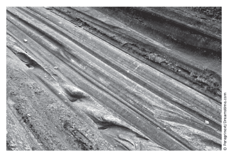
The picture shows scratches in bedrock that were once caused by a moving glacier. These scratches are called glacial striations. Glacial Striations in the bedrock of South America indicated that glaciers once moved across the African continent. The presence of glaciers on the surface of Africa is evidence that -
the tectonic plate under Africa was closer to the South Pole at one time
the location of the North Pole and the South Pole changed
the equator was not always where it is currently located
volcanoes did not exist until after faults occurred in Earth's crust
Which event can the students best demonstrate with their models?

formation of a rift valley
building up of a mountain
a volcanic eruption
an earthquake
The picture shows scratches in bedrock that were once caused by a moving glacier. These scratches are called glacial striations. Glacial Striations in the bedrock of South America indicated that glaciers once moved across the African continent. The presence of glaciers on the surface of Africa is evidence that -
Which event can the students best demonstrate with their models?
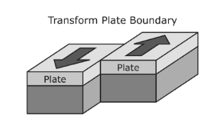
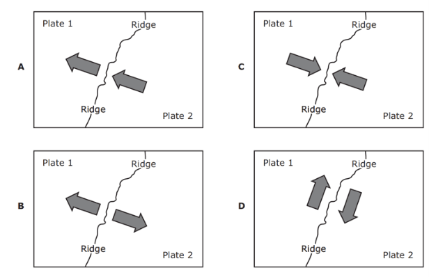
Which diagram correctly models the relative plate motion of each side of a mid-ocean ridge?
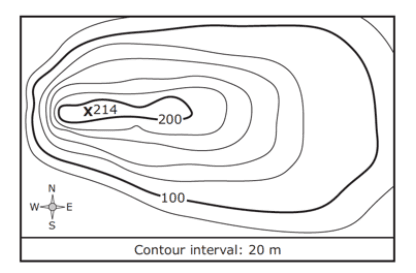
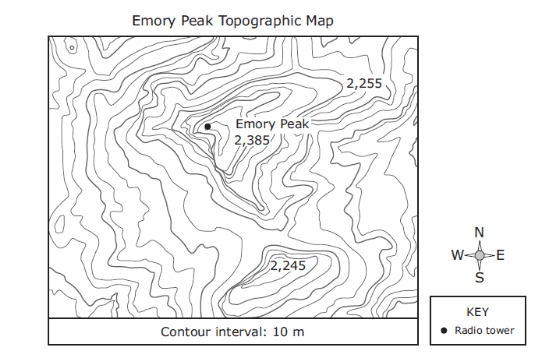
Based on the topographic map, if a park ranger hiked due west from the radio tower, the ranger's path would -
Which profile most likely represents the landscape today?