Interpret topographic maps and satellite views to identify land and erosional features and predict how these features may be reshaped by weathering.
Track each student's skills and progress in your Mastery dashboards
Give this quiz to my class
Q 1/10
Score 0
Scientists recently discovered that rocks collected from the Franklin Mountains in West Texas and rocks collected from mountains in eastern Antarctica were exactly the same age. Further research showed that the rocks were chemically and geologically the same and came from the same magma source. This discovery provides evidence of —
30
plate tectonics
glacial melting
coastal erosion
ocean currents
Q 2/10
Score 0
Which landform or landforms can be created from a Convergent Boundary?
30
Mid-Ocean Ridge
Seafloor Spreading
Mountains
Earthquakes
10 questions
Q.
Scientists recently discovered that rocks collected from the Franklin Mountains in West Texas and rocks collected from mountains in eastern Antarctica were exactly the same age. Further research showed that the rocks were chemically and geologically the same and came from the same magma source. This discovery provides evidence of —
1
30 sec
8.9a
Q.
Which landform or landforms can be created from a Convergent Boundary?
2
30 sec
8.9a
Q.
What do you called the entire lithosphere of the Earth that is broken into numerous segments?
3
30 sec
8.9a
Q.
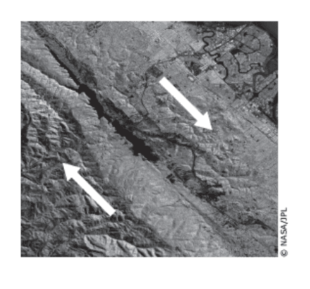
The image shows a plate boundary. Arrows have been added to indicate the movement of the plates. What plate boundary feature is also shown?
4
30 sec
8.9b
Q.
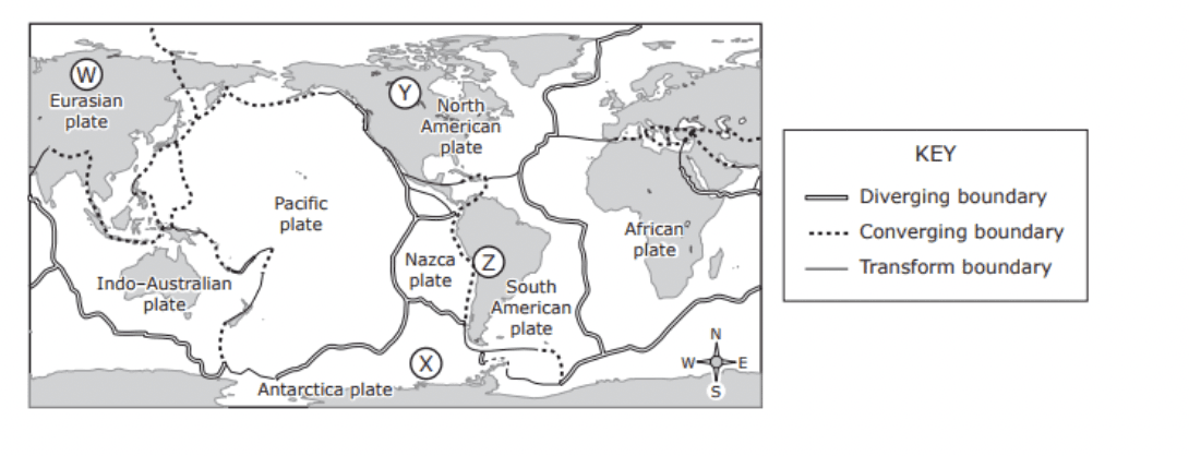
The map shows some of Earth’s plate tectonic boundaries. Based on the map, volcanic activity would most likely be found at —
5
30 sec
8.9b
Q.
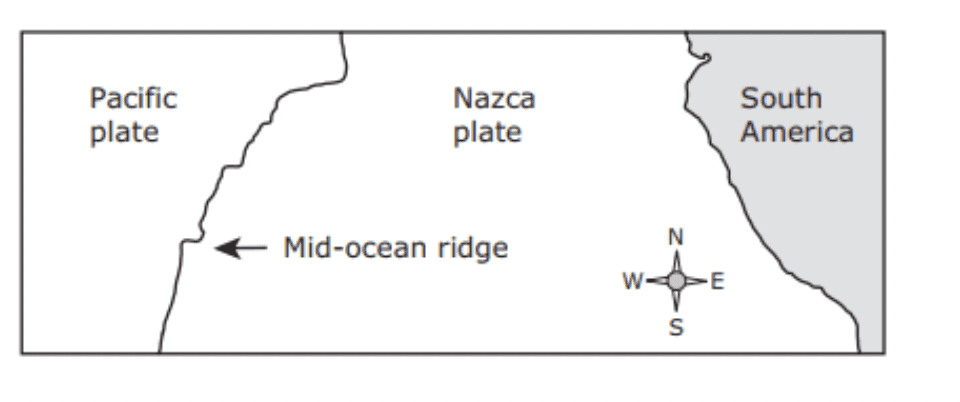
A mid-ocean ridge separates the Pacific plate and the Nazca plate off the western coast of South America. Which statement best describes the relative motions of the Pacific and Nazca plates?
6
30 sec
8.9b
Q.
Scientists recently discovered that rocks collected from the Franklin Mountains in West Texas and rocks collected from mountains in eastern Antarctica were exactly the same age. Further research showed that the rocks were chemically and geologically the same and came from the same magma source. This discovery provides evidence of —
7
30 sec
8.9b
Q.
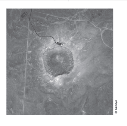
The satellite photograph below shows a large meteorite crater that is 1200 m in diameter and 170 m deep. This crater is located in a flat, arid part of northeastern Arizona. How will this crater most likely change over time?
8
30 sec
8.9c
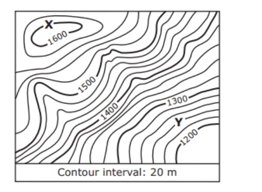
Q.
A section of a topographic map is shown below. What is the difference in elevation in meters between Point X and Point Y on the map? Be sure to use the correct place value.
9
30 sec
8.9c
Q.
The satellite photo below shows San Francisco, California, which has many miles of coastline and an inland bay. Which area of the coastline has most likely experienced the greatest effect of erosion from waves over hundreds of years?