recognize how landforms such as deltas, canyons, and sand dunes are the result of changes to Earth's surface by wind, water, and ice
Track each student's skills and progress in your Mastery dashboards
Give this quiz to my class
Q 1/8
Score 0
Glaciers are masses of ice that move slowly on land. Which of these features was most likely formed by a glacier?
60
A lava flow
A wide valley
A deep ocean
A mountain range
Q 2/8
Score 0
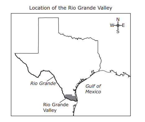
The Rio Grande Valley is located at the southern tip of Texas at the end of a long river known as the Rio Grande. How did the delta at the end of the Rio Grande form?
60
Hurricanes pushed soil and debris from the Gulf of Mexico onto the land.
Sand and mud from the Gulf of Mexico were washed ashore by tsunamis
The river deposited large amounts of sediment from land erosion
The river cut through the solid bedrock of the valley.
8 questions
Q.
Glaciers are masses of ice that move slowly on land. Which of these features was most likely formed by a glacier?
1
60 sec
5.7.B: Earth and Space
Q.
The Rio Grande Valley is located at the southern tip of Texas at the end of a long river known as the Rio Grande. How did the delta at the end of the Rio Grande form?
2
60 sec
5.7.B: Earth and Space
Q.
A student hiking in a rocky area on a mountain notices that wide, deep cracks have formed in some of the large rocks. Some of the cracks are so large that the rocks have broken apart. Which process most likely caused these rocks to crack and break?
3
60 sec
5.7.B: Earth and Space
Q.
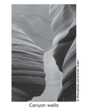
The photograph below shows a canyon in northern Arizona.
Which of these describes how this canyon was most likely formed?
4
60 sec
5.7.B: Earth and Space
Q.
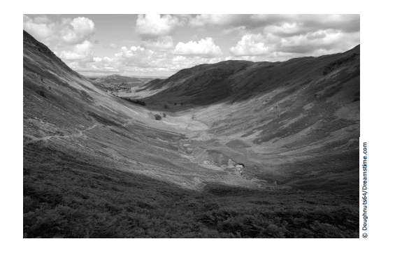
A wide U-shaped valley is shown in the photograph below. This valley was most likely formed by —
5
60 sec
5.7.B: Earth and Space
Q.
Students constructed this model of a hill by covering sugar cubes with clay. The students placed the model in a large pan and poured hot water over it every day for a week. What does the model best represent?
6
60 sec
5.7.B: Earth and Space
Q.
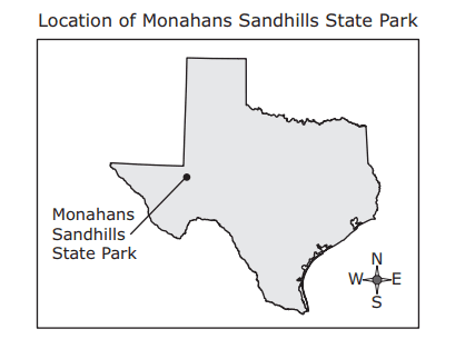
Monahans Sandhills State Park in Texas has almost 4,000 acres of sand dunes. Some of the dunes are as tall as a six-story building. The dunes in the park are formed by —
7
60 sec
5.7.B: Earth and Space
Q.
The size and shape of a delta can change over time.The size and shape of this delta over time are NOT likely to be changed by —